Hail larger than grapefruits pummeled towns along the Red River Valley Friday evening in an explosive atmosphere.
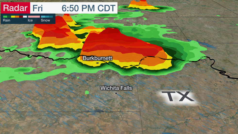
The biggest hail fell in the community of Burkburnett, Texas, located northwest of Fort Worth along the Oklahoma border.
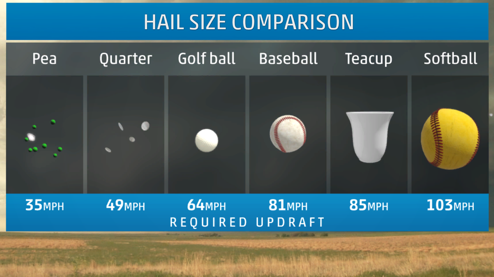
Some stones were as large as 5.33 inches in diameter, according to the National Weather Service.
We may never know exactly how big these stones were because the family that recorded them had to wait out the storm to retrieve them. This means that the hail likely melted some before they were measured.
This kind of hail is dangerous and can be deadly for anyone outside while stones of this size are falling.
Thankfully, nobody was injured in storms in Texas or Oklahoma on Friday evening.
How do you get hailstones this big?
The basic ingredients for large hail are extreme heating and moisture. Temperatures approached 90 degrees near the ground with dew points in the low 70s before these storms arrived.
In the case of Friday evening's thunderstorms, the atmosphere was primed for explosive development well above the ground.
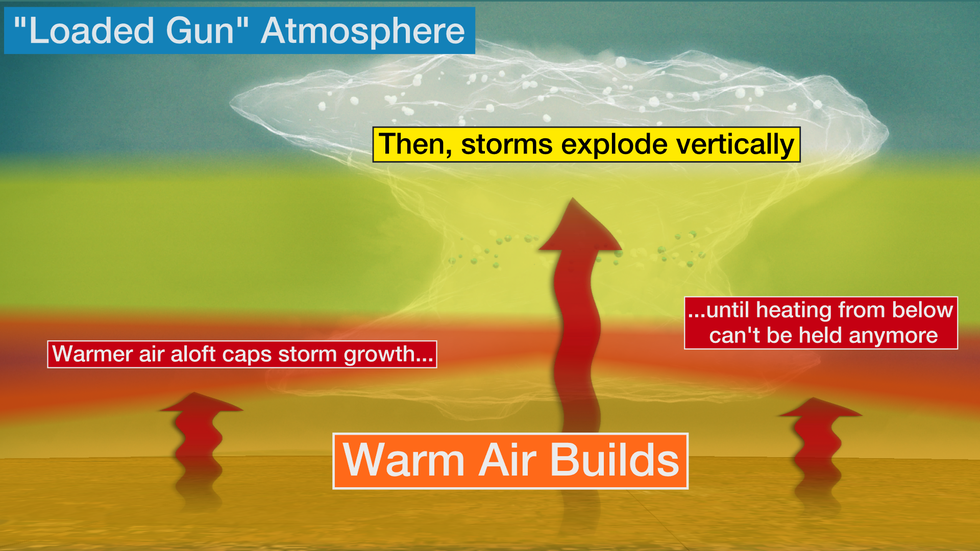
Several thunderstorms developed in what is often called a "loaded gun" atmospheric setup.

Weather balloons launched in Texas and Oklahoma Friday afternoon suggested that heat was building, but so was a large lid on that heat.
Think of an old-fashioned popcorn maker.
When heat starts making the kernels pop, they start popping faster and faster and eventually the lid comes off. The kernels don't stop popping until there are none left.
The atmosphere acts the exact same way.
In order to get thunderstorms to grow, the atmosphere has to be unstable, which happens when the air closer to the ground is warmer than the air above it.
But if the atmosphere was unstable from the ground to the top of the atmosphere, thunderstorms would leisurely grow taller and eventually run out of steam throughout the afternoon and evening.
Friday's storms had a strong lid, or atmospheric cap, that kept all of the heat and moisture closer to the ground.
This cap occurs when air rapidly warms with height for a small layer of the atmosphere.
Thunderstorms that can get through this layer are able to explosively grow vertically. This kind of setup is called a "loaded gun" atmosphere because storms often start with a bang.

Once storms push through the cap, they do so with so much gusto that raindrops and hailstones are flung thousands of feet into the sky.
Friday's grapefruit-size hail likely rode atop updrafts moving at more than 150 mph toward the top of the atmosphere.

This kind of violent atmospheric setup also supports tornado growth.
As storms grow rapidly taller, they also stretch and spin. If that spin can reach the ground, you get a tornado.
There were four reports of tornadoes in Texas and Oklahoma on Friday evening.
The Weather Company’s primary journalistic mission is to report on breaking weather news, the environment and the importance of science to our lives. This story does not necessarily represent the position of our parent company, IBM.

No comments:
Post a Comment