Published: April 23, 2020
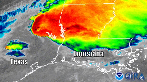
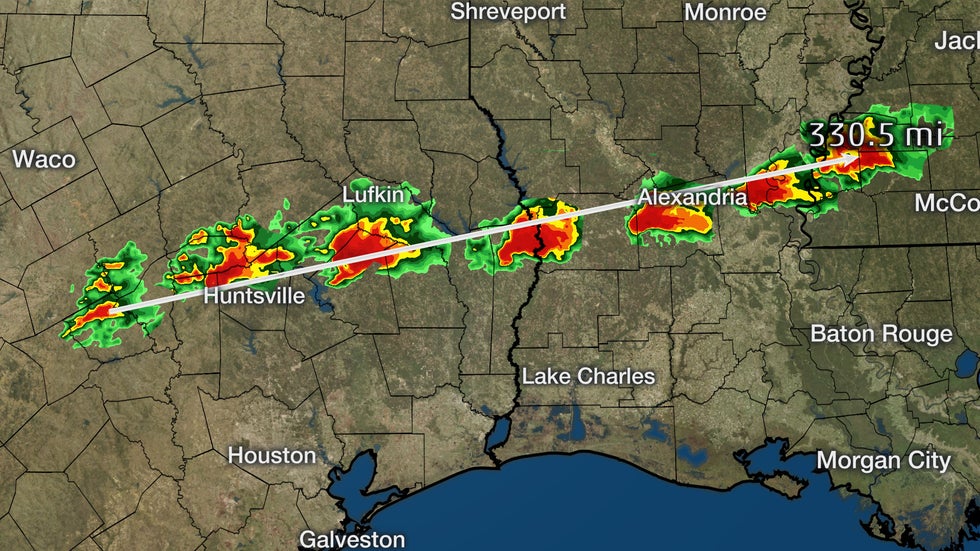 The general track of the supercell from when it began to form in eastern Texas to when it began to dissipate near the border between Louisiana and Mississippi.
A long-lived supercell thunderstorm tracked nearly 300 miles in three states and likely spawned multiple tornadoes on Wednesday, including a deadly twister in Texas.
The term supercell is used by meteorologists to describe a breed of long-lasting thunderstorms that rotate and are accompanied by dangerous weather conditions, including large hail, damaging winds and sometimes tornadoes. Fewer than 20% of supercells produce tornadoes, but the majority of all tornadoes occur in supercells.
Wednesday's supercell first showed signs of developing in east Texas during the mid-afternoon hours about 3 p.m. CDT. From there, it tracked for several hours into Louisiana before weakening as it began to cross into Mississippi before midnight. Since it was ongoing for more than four hours, it's classified as a long-lived supercell, according to a 2005 study.
You can see the general track of the supercell in the graphic at the top of this article, that shows it covered a distance of nearly 300 miles, or possibly more, from when it first began to develop to when it weakened.
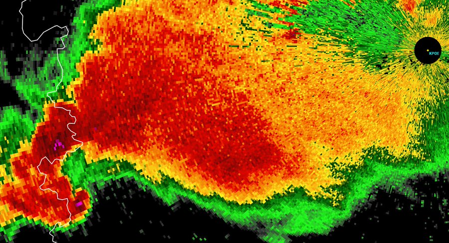
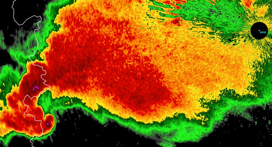
 Radar image of a supercell in southwestern Oklahoma on Nov. 7, 2011. The hook echo and hail core are labeled.
Supercells have a distinct appearance on Doppler radar, which often features a so-called hook echo on the lower-left portion of the storm. That hook echo appendage extends southward from the thunderstorm's main core, where large hail and heavy rain are typically located. When tornadoes are spawned by supercells, they are near the hook echo on radar.
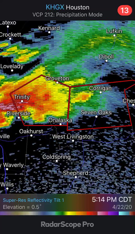
Wednesday's supercell had this so-called hook echo along the majority of its path. You can see this in the radar animation below, when a strong tornado was ongoing near the hook echo in Onalaska, Texas. The tornado caused major damage in the town and killed three people.
There were multiple additional reports of tornadoes along the path of this supercell, including near Jasper, Texas, and south of Alexandria, Louisiana. Here's another animation of this supercell's hook echo as it crossed into Louisiana from Texas.
The National Weather Service will survey areas where this supercell tracked to determine how many tornadoes it produced.
More About Supercells
Classic supercells appear as individual storms like we showed earlier, but sometimes can be embedded within a line or cluster of thunderstorms.
The National Severe Storms Laboratory (NSSL) said fewer than 20% of all supercell thunderstorms produce tornadoes. However, supercells are responsible for spawning the vast majority of all tornadoes – violent ones in particular – NSSL added. More research is underway to discover why some of these rotating thunderstorms are accompanied by tornadoes while others are not.
#SATELLITE SPOTLIGHT: On April 22-23, @NOAA's #GOES16watched this incredibly long-lived #supercell #thunderstorm that tracked from #EastTexas to #Mississippi, producing several reports of damaging #tornadoes along the way. Today, the risk for #severe #weather shifts eastward.
29 people are talking about this
Supercell thunderstorms are sometimes referred to as low precipitation (LP) or high precipitation (HP).
As the name implies, an LP supercell is accompanied by lighter amounts of precipitation – rain or hail. This type of supercell is easy to spot in the Plains because there is a clear view of the structure.
HP supercells contain heavier concentrations of rain and hail. The precipitation can sometimes obscure the storm's structure, including wall clouds and tornadoes. Tornadoes obscured by heavy precipitation are typically known as "rain-wrapped."
When supercells develop in a volatile atmospheric environment, they can survive for dozens or even hundreds of miles over multiple hours. The best-organized supercells may spawn multiple tornadoes, some of which can stay on the ground for a lengthy period of time.
Low-pressure systems in various regions of the world can spawn supercell thunderstorms when atmospheric conditions are ripe. They can also occur in landfalling tropical storms and hurricanes.
The Science Behind How Supercells Form
A supercell thunderstorm is characterized by a sustained and powerful rotating updraft (rising air). These storms originate in unstable air that is paired with as wind shear, or winds changing direction at various altitudes in the atmosphere. A common combination supportive of supercells often found in the Plains states is a southerly or southeasterly wind near ground level and a southwesterly or westerly wind higher in the atmosphere.
This combination of changing wind directions and speeds creates a horizontal rolling motion in the lower atmosphere. The same rapidly rising air motions that form the thunderstorm turn this horizontal rotation into a vertical rotation, which can then be spectacularly evident in the circular striations, or layers, visible in the cloud structure of the supercell.
The Weather Company’s primary journalistic mission is to report on breaking weather news, the environment and the importance of science to our lives. This story does not necessarily represent the position of our parent company, IBM.
The Weather Company’s primary journalistic mission is to report on breaking weather news, the environment and the importance of science to our lives. This story does not necessarily represent the position of our parent company, IBM.





No comments:
Post a Comment