Published: April 17, 2020
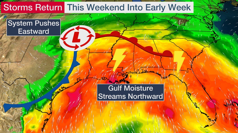
 The setup for severe weather Sunday in the South.
Severe thunderstorms and tornadoes are once again a threat this weekend in the South, including areas still recovering from recent tornadoes.
Over 125 tornadoes were spawned over the South during the Easter outbreak from April 12-13, primarily from Texas to the Carolinas, including a pair of EF4 tornadoes, one of which was over two miles wide in Mississippi.
High pressure has brought several days of dry conditions to the storm-fatigued South this week. This will change beginning Friday in parts of the region.
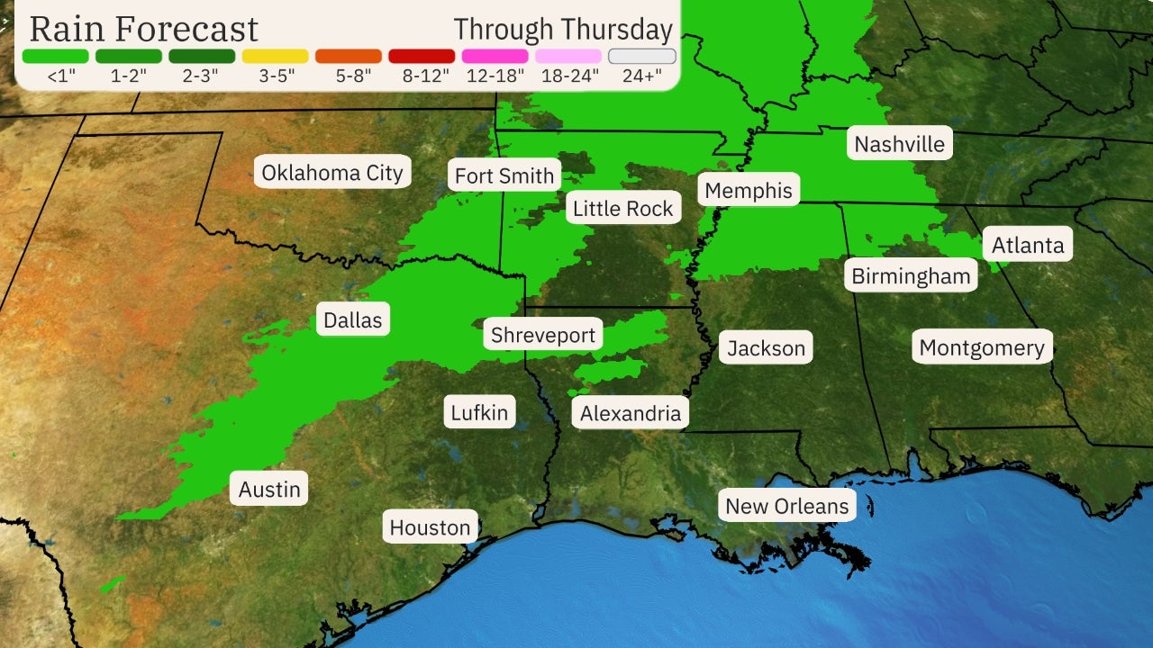
A cold front will drop into the South by Friday night, bringing scattered showers and thunderstorms from parts of Texas into the lower Mississippi Valley, Tennessee Valley and the northern Gulf Coast. Fortunately, these aren't expected to be severe.
Attention will shift back toward the Southern Plains late Saturday as a disturbance moves out of the Southwest into the Plains. Moisture will flow back northward from the Gulf of Mexico as this next system tracks east. In addition, strong winds aloft will support severe thunderstorms as this low-pressure system moves across the South through Sunday night.
Below, we take a closer look at the day-by-day forecast into early next week. Details will change over the next few days, so be sure to check back to weather.com for updates.
Stormy Forecast
Saturday
A few severe thunderstorms are possible Saturday afternoon and evening from central Texas into the lower Mississippi Valley. Large hail will be the primary threat there.
 Saturday - Saturday Night Severe Thunderstorm Forecast
A separate cold front over northern Florida could spawn severe thunderstorms from Interstate-10 down to Interstate-4. These thunderstorms could bring damaging wind gusts and a tornado or two. If local sea breezes develop along Florida's east coast, a locally higher severe threat could exist.
Thunderstorms could begin Saturday morning, then move east or southeastward during the afternoon.
Sunday
This looks to be the most active day for severe weather.
Thunderstorms will likely form early Sunday in Texas, then spread across Louisiana, Mississippi and Alabama Sunday afternoon, then Georgia, parts of the Carolinas and North Florida Sunday night, potentially lasting overnight.
Supercell thunderstorms are possible before a large cluster of thunderstorms, also known as a mesoscale convective system, eventually develops and sweeps eastward with damaging thunderstorm winds and hail.
Some tornadoes are expected, both spawned by supercells and embedded within the squall line of severe thunderstorms.
But the overall setup does not look as favorable for as numerous and intense tornadoes as we saw across the South on Easter Sunday and Monday.
 Sunday - Sunday Night Severe Thunderstorm Forecast
This severe threat should largely end by Monday, with the exception of some isolated strong storms that may linger in parts of northern and central Florida.
Rainfall Forecast
Much of the South can expect 1 to 3 inches of rainfall through Monday. Locally higher totals are possible where repeated thunderstorms occur or where storms move more slowly.
 Rainfall Forecast
The ground is already saturated across much of the region given recent rainfall. This increases the chance for flash flooding.
NOAA's Weather Prediction Center issued a moderate risk - their second highest risk category - for excessive rain Sunday and Sunday night from eastern Mississippi to western South Carolina.
 Sunday's Flood Risk
River levels remain high, and many gauges in the lower Mississippi Valley are in at least minor flood stage. Additional rainfall will raise levels in rivers and creeks, increasing flooding concerns.
A brief break from storms is anticipated early next week in the South before another system moves into the Plains. This next system will also likely bring severe thunderstorms to parts of the Plains and South, possibly as early as Tuesday in some areas.
(MAPS: U.S. Daily Forecast Next 7 Days)
The multiple severe threats over the next several days are not unusual for this time of year, as March and April are the peak time for tornadoes in Dixie Alley.
Severe Weather and Coronavirus: Do I Shelter?
If you don't have a safe place to seek shelter from a storm, should you find a public shelter in this age of COVID-19?
The simple answer: yes.
However, sheltering may be more difficult over the next few months.
"Do not let the virus prevent you from seeking refuge from a tornado," the American Meteorological Society said in a statement issued on April 9. "If a public tornado shelter is your best available refuge from severe weather, take steps to ensure you follow CDC guidelines for physical distancing and disease prevention."
But you need to know where to go and IF you can go to a shelter BEFORE a storm threatens.
“Most government entities use schools … you can only get so many people in those schools," Steven Still, director of emergency management in New Hanover County, North Carolina, told weather.com.
Of course, many schools are closed during this pandemic, so your normal shelter may not be open. And those shelters that are open may not accept as many people.
In all cases, if you are in a mobile home, absolutely find a different shelter option.
The Weather Company’s primary journalistic mission is to report on breaking weather news, the environment and the importance of science to our lives. This story does not necessarily represent the position of our parent company, IBM.
The Weather Company’s primary journalistic mission is to report on breaking weather news, the environment and the importance of science to our lives. This story does not necessarily represent the position of our parent company, IBM.

No comments:
Post a Comment