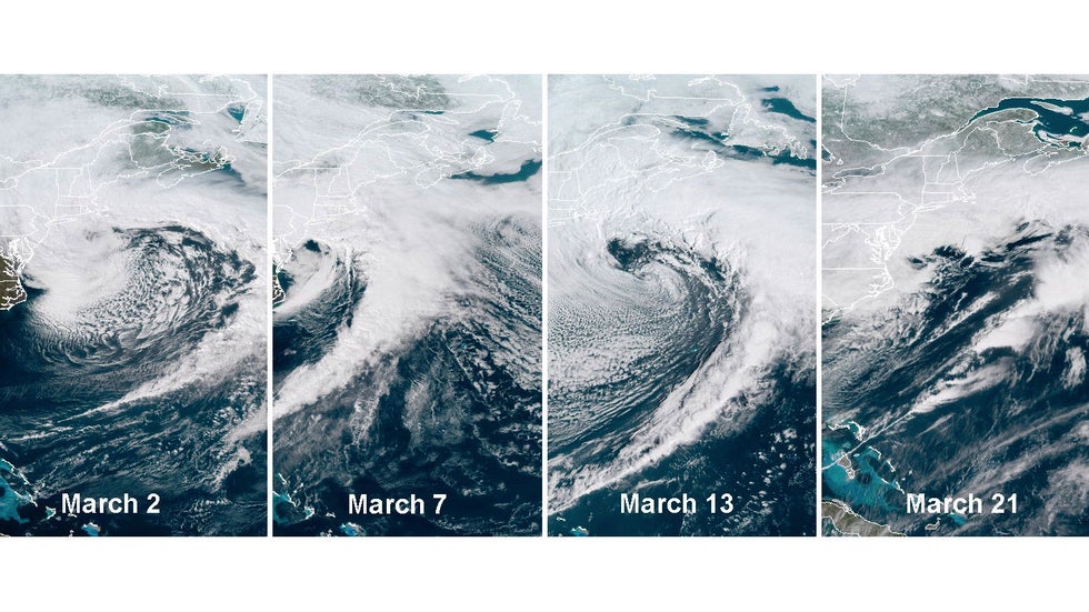
 Satellite of the four nor'easters in March 2018.
This March will mark two years since the last time a "high-impact snowstorm" hit the Northeast urban corridor, according to the Northeast Snowfall Impact Scale (NESIS).
In 2004, Paul Kocin, a National Weather Service meteorologist, and Dr. Louis Uccellini, the director of the National Weather Service, developed the scale to rank the impact of Northeast snowstorms based on snowfall amounts and the population affected.
In general, widespread heavy snowfall over highly populated areas like the Interstate 95 corridor from Boston to Washington, D.C. produces a high NESIS value. The storms are ranked Category 1 (notable) to Category 5 (extreme) based on the value.
The last time a Northeast urban corridor winter storm ranked as at least a Category 1 on the NESIS was March 2018, when four Nor'easters pummelled the East Coast in three weeks. Those storms all ranked either Category 1 or 2.
Since then, there has been a dearth of significant, widespread snowstorms in the Northeast urban corridor. Snow and ice have been impactful at times, but none of the events have been heavy or widespread enough to earn at least a Category 1 NESIS rating.
This winter has been especially quiet in the so-called megalopolis. Season snowfall totals to date in New York City, Philadelphia and Washington, D.C. are among the 10 least for a season in more than 130 years of records.
That's because the general track of significant winter storms has been northeastward across the central United States. This storm track draws milder air into the Northeast, resulting in more rain than snow.
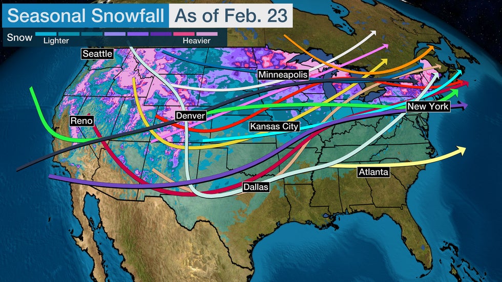 The arrows represent the tracks of significant winter storms so far this season. The shaded areas are estimates of total snowfall this season.
Assuming March remains quiet as well, how unusual would it be for the Northeast urban corridor to go through two winters in a row with no high-impact snowstorms?
Until last winter, there was at least one winter storm for 10 consecutive snow seasons with a NESIS rating of Category 1 or greater. Six of those 10 seasons had multiple storms with a Category 1 or higher rating.
But we have to go back further in time to find the last time a high-impact snowstorm failed to appear in back-to-back winters. That last happened in the 1998-1999 and 1997-1998 snow seasons.
The Weather Company’s primary journalistic mission is to report on breaking weather news, the environment and the importance of science to our lives. This story does not necessarily represent the position of our parent company, IBM.
The Weather Company’s primary journalistic mission is to report on breaking weather news, the environment and the importance of science to our lives. This story does not necessarily represent the position of our parent company, IBM.


No comments:
Post a Comment