WEATHER NEWS Updated Jan. 18, 2020 2:01 PM
Snow and ice sweeping through the Northeast will likely bring travel difficulties for travelers during the long holiday weekend, even in cities like Philadelphia, New York City, and Boston.
New York City Emergency Management issued a Travel Advisory for Saturday as a Winter Weather Advisory took effect in the city.
The Winter Weather Advisories are in effect from midmorning on Saturday until Sunday morning for northeastern New Jersey, the upper boroughs of New York City, the Lower Hudson Valley in New York, and southern Connecticut, for 2 to 5 inches of snowfall.
“As we head into the weekend, I want to advise New Yorkers to prepare for the winter weather that’s moving into our area. With snow in the forecast for Saturday, give yourself some extra travel time, exercise caution, and use public transportation where possible,” said New York City Emergency Management Commissioner Deanne Criswell.
Enough snow and freezing rain will accumulate on trees and power lines in some areas which can lead to tree damage and the loss of power for several days.

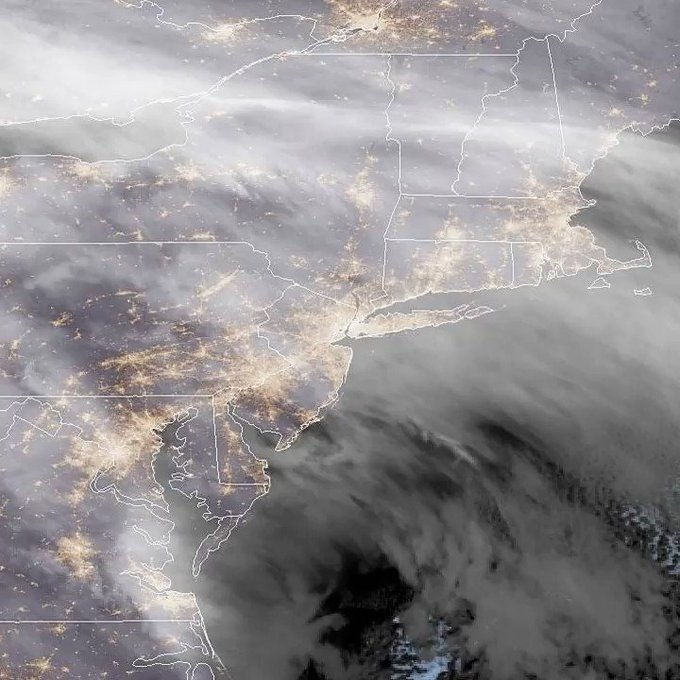
The above radar image shows the powerful storm making its way east early Saturday afternoon, coating the northeast in snow and freezing rain.
Strong winds will continue to develop into Saturday as the area of low pressure strengthens across the Great Lakes. This could lead to blowing and drifting snow in the storm's wake, resulting in a whiteout and perhaps localized blizzard conditions.
The Mackinac Bridge in Michigan, which is the longest suspension bridge in the Western Hemisphere, is requiring escorts for high-profile vehicles due to high winds of almost 50 mph on Saturday morning. Bridge personnel are stationed at both ends of the bridge to give instructions.
“Since temperatures are well below freezing in advance of the storm, snow is expected to start accumulating shortly after it begins. As a result, untreated surfaces can quickly become slick,” AccuWeather Meteorologist Adam Douty said.
The snowfall will spread into upstate New York and northern New England through the day on Saturday and Saturday night, according to AccuWeather meteorologists.
Due to winter weather conditions, the Pennsylvania Department of Transportation said the speed limit on Interstates 90, 86 and 79 in Erie, Crawford, Venango, and Mercer counties has been temporarily reduced to 45 mph.
The speed limit has also been reduced in Pennsylvania on I-180 westbound to 45 mph and commercial vehicles must use the right lane only.

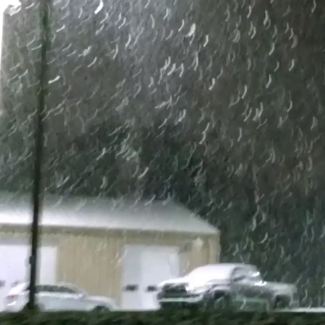
A car ran off of the road during wintry weather conditions in Thornburry, Pennsylvania. Twitter/sadgirlWRX
The National Weather Service in Pennsylvania recorded 1.1 inches of snow in Moon, Pennsylvania, early Saturday morning.
“As warmer air pushes into the cold air, it will cause snow to mix with sleet and freezing rain across much of Pennsylvania and western New York during the day on Saturday,” Douty said.
If the storm strengthens more than expected, wind gusts could be a problem. High winds mixed with snow could create white-out conditions and even blizzard conditions if the storm is strong enough.
“Across New England, where cold air will be more stubborn to leave, snow is expected to be the primary precipitation type,” Douty said.
The mountains of northwestern Pennsylvania and southwestern New York could also have 6-12 inches of snow due to lake enhancement.
RELATED:
Strong winds can lead to blowing and drifting snow and reduced visibility across portions of the Northeast. This can lead to travel delays and hamper clean-up efforts.
“Travel across the Northeast will become more difficult as the day progresses and snow overspreads the region,” Douty said.
Not only will travel be impacted for those traveling by road, but air travel will also be impacted. Flight delays and cancellations are likely to continue into the weekend as the storm tracks northeastward across the nation.
Major transportation hubs including St. Louis, Chicago, Detroit, LaGuardia, JFK, Philadelphia and Washington, D.C., will also be impacted by this storm. Therefore, delays or cancellations may ripple across the nation as flights struggle to get in and out of airports.
CLICK HERE FOR THE FREE ACCUWEATHER APP to see the hour-by-hour forecast, projected snowfall and the probability of accumulations for your specific location.
Road crews will continue to move snow off roads, but this process could take a long time, especially in the hardest-hit areas. Residents in these areas should be patient with road crews as they work to clear the roads.
Even when roads are being cleared across the Northeast, conditions can quickly change from main roads to secondary roads and from town to town. Anyone out driving after the storm should take extreme caution and be prepared for changing conditions.
Keep checking back on AccuWeather.com and stay tuned to the AccuWeather Network on DirecTV, Frontier and Verizon Fios.


No comments:
Post a Comment