Saturday, November 30, 2019

Cross-Country Storm Is Bringing Blizzard Conditions to Plains & Parts of Northeast May See First Significant Snow

weather.com meteorologistsPublished: November 30, 2019


Snow and strong winds are creating blizzard conditions, as a powerful storm moves from the Plains into the eastern United States this weekend. This could be the first major snow of the season for areas from New York City to Boston late Sunday into Monday.
The Weather Channel has named this system Winter Storm Ezekiel.

Happening Now

Snow and gusty winds will create dangerous travel conditions in the Upper Midwest overnight. Ground blizzard conditions could continue in the northern Plains overnight, as well.
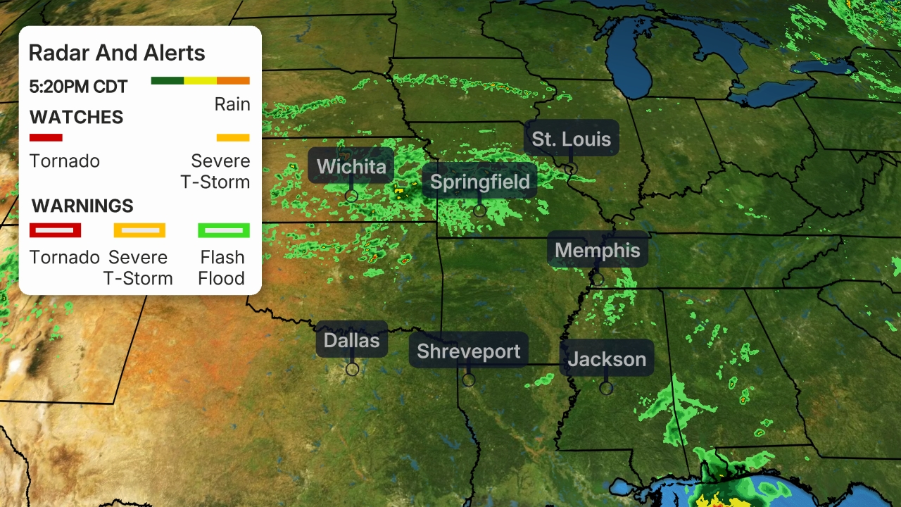
Current Radar and Wind
Blowing snow and strong winds have closed numerous roads in the Plains, including parts of Interstate 80 in Wyoming and Nebraska. A "no travel advisory" has been issued by the city of Duluth, Minnesota and in Rapid City, South Dakota. Travel is also discouraged from parts of Colorado to western South Dakota. Thundersnow was reported in parts of western South Dakota midday Saturday.
Blizzard conditions have been reported is several spots in Wyoming, including near Arlington, Vedauwoo, Whitaker and Warren Air Force Base, Saturday morning where frequent wind gusts of 45 to 55 mph were occurring. Harrisburg, Nebraska and Rapid City and Ellsworth, South Dakota have also reported blizzard conditions on Saturday with visibility below a quarter mile and frequent wind gusts of at least 35 mph over three hours.
Even as the snow stops falling from the sky, ground blizzard conditions are being reported in Wyoming as winds whip up the freshly fallen snow. Laramie also reported near blizzard conditions Saturday afternoon.
Early Saturday, Rochester, Minnesota, reported 0.13 inches of freezing rain. Up to a half inch of ice was estimated to have accumulated near Bredette, Montana, Saturday morning which caused tree limbs to sag significantly. Killdeer, North Dakota reported a quarter inch of ice had accumulated on power lines and tree branches as of midday Saturday.
Heavy snow and strong winds disrupted Thanksgiving travel in parts of the West. As of early Saturday, 48 inches of snow was measured at Big Bear Lake, California, as well as at Snowbasin, Utah.
Wind gusts over 80 mph were measured late Friday and early Saturday in parts of Colorado, including a gust to 91 mph near Nederland (located west of Boulder). A wind gust of 112 mph was measured at Brighton, Utha, where the elevation is 10,565 feet.
Additional storm reports can be found farther down in this article.

Current Winter Alerts

Blizzard warnings have been issued for portions of eastern Wyoming, western South Dakota and northern Nebraska, as well as in northeastern Minnesota, including Duluth. A blizzard occurs when sustained winds of frequent gusts to at least 35 mph and considerable falling and/or blowing snow that frequently reduces visibility to less than a quarter-mile.
Winter storm warnings and winter weather advisories have been issued by the National Weather Service across a broad area of the Plains and upper Midwest.
The worst conditions are likely in areas where winter storm warnings and blizzard warnings are in effect. Some locations in these warnings may be impossible to travel through.
Winter Weather Alerts
Winter storm warnings, watches and winter weather advisories have been issued by the National Weather Service for parts of the Northeast. This includes Boston, Hartford, Albany and Syracuse. These area locations where moderate to heavy snowfall may create hazardous conditions and may travel very difficult later this weekend.
An ice storm warning has also been issued for parts of Pennsylvania and far western Maryland beginning Saturday night. Significant icing is expected from freezing rain here with ice accumulations of more than a quarter inch possible. Ice accumulation of a quarter inch or greater can damage trees and power lines and roads become slippery.
Closer to the coast, including much of the Interstate 95 corridor, may see a mix of precipitation types and less snow. There is greater uncertainty in the forecast here.
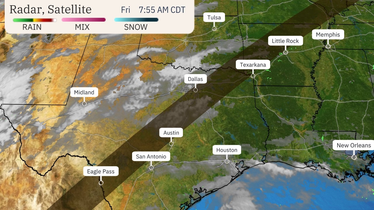
Winter Weather Alerts
High wind warnings and wind advisories have also been posted by the National Weather Service for parts of the West and Plains. Wind gusts over 60 mph are likely in areas under a high wind warning. These winds will make travel tricky, especially for high-profile vehicles. Some wind gusts could also cause some power outages.
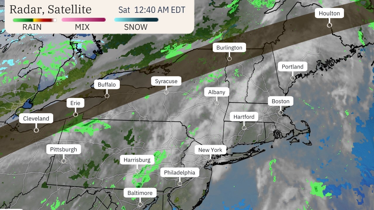
Wind Alerts
Below is the forecast for the next few days. You can also find a recap of how this storm became a bomb cyclone when it first struck northwestern California and southwestern Oregon Tuesday.

Forecast Timing

Sunday
By Sunday, Ezekiel could bring snow from the upper Midwest to New England, with rain from the mid-Atlantic to the Southeast.
Heavy snow may fall in the Upper Midwest and parts of the interior Northeast. Gusty winds are likely as well.
A second low will develop off the Northeast coast and will likely track relatively close to the coast which will result in a mix of snow, sleet, freezing rain and rain in the Northeast.
At this time it looks like, precipitation will likely begin as snow Sunday from eastern Pennsylvania into southern New England before warmer air changes the precipitation to sleet, freezing rain and rain, especially closer to the coast.
New York City and Boston may see several changes between rain and snow back and forth during the day. Winds may become gusty across southern New England late in the day.
These details will likely change, so be sure to check back for updates.
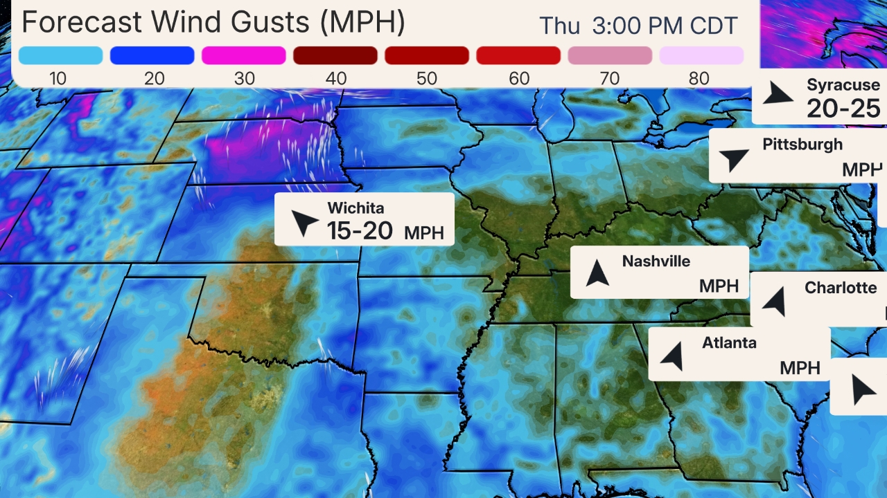
Sunday's Forecast
Monday
An area of low pressure will be strengthening and slowly tracking just off the Northeast coast early next week. The National Weather Service in Boston noted Friday morning that "confidence continues to increase that we will see a significant and long duration winter storm affect southern New England from Sunday through early Tuesday."
The details remain uncertain but the chance for snow and strong winds is increasing in the Northeast and this system will remain in the region for nearly 48 hours.
Areas that changed to rain, sleet and freezing rain on Sunday will likely transition back to snow before ending later Monday.
Areas farther west and north of the I-95 corridor will likely see all snow from this system. Locations near the coast may see less snow.
Monday's Forecast
Snow may linger into early Tuesday in parts of New England.

Snowfall Forecast

Portions of the Northern Plains could pick up several more inches of additional snow. The heavy snow combined with strong winds may create snow drifts feet high.
Moderate to heavy snow is expected from northern and central Minnesota into northern Wisconsin and northern Michigan through Sunday.
Rain and Snow Forecast
Areas from northeastern Pennsylvania into parts of New England could pick up significant snowfall accumulations into Tuesday.
The exact snowfall totals remain uncertain, especially closer to the Northeast coast where rain and sleet could mix in, so be sure to check back for updates.
Snowfall Forecast

Storm Impacts

Portions of Interstate 5 were closed in southern California due to heavy snow for much of Thanksgiving. Travel through the Southern California mountains will remain dangerous into Friday.
An unusual amount of snow even in the lower elevations of Southern California, including Palmdale where more than 3 inches has fallen so far.
Some minor ice accumulations have made roads and bridges slick in portions of Kansas and Missouri Thanksgiving morning.
Strong winds and snow have created white out conditions at times Friday in northern Arizona, as well as Colorado.
Highways were closed in northern Arizona Thursday night into Friday morning, including Interstates 17 and 40, due to snow, the Associated Press reported. The Flagstaff area reported 8 to 12 inches of snow as of early Friday.
Flash flooding was reported in portions of Arizona early Friday, with roads closed near Gila Bend and New River. A driver became stuck in a flooded area of state route 74 near New River and was rescued.
Thunderstorms damaged trees near Higley, Arizona and numerous trees were downed by thunderstorm winds near North Scottsdale, Arizona, early Friday. Roof damage was reported near Avra Valley, Arizona, and a carport was blown collapsed on a car near Glendale, Arizona.

Snowfall Totals

Here are some top snowfall totals by state, as of midday Saturday.
Arizona: 30 inches at Arizona Snowbowl; 19 inches near downtown Flagstaff
California: 48 inches at Big Bear Resort (elevation 8,500 feet)
Colorado: 15 inches at Wolf Creek Pass
Idaho: 20 inches (estimated) at Sun Valley Resort
Minnesota: 3 inches at Mankato; 0.13 inches of ice at Rochester
Montana: 15 inches near Marysville
Nebraska: 12 inches at Chadron
Nevada: 12 inches near Incline Village at Diamond Peak Ski Resort
New Mexico: 16.6 inches near Black Lake
North Dakota: 8 inches at Ashley
Oregon: 15 inches (estimated) near Rock Creek
South Dakota: 10 inches at downtown Rapid City
Utah: 48 inches at Snowbasin Resort (elevation 7,402 feet)
Wyoming: 12 inches at Lusk
Estimated Snowfall

Bomb Cyclone Recap

As this intense storm approached the coasts of southwestern Oregon and northwestern California Tuesday evening, it underwent bombogenesis. The storm's minimum central pressure dropped 43 millibars in 24 hours, far exceeding the criteria of 24 millibars within 24 hours to be deemed a bomb cyclone. What this means is that the storm is unusually intense and capable of producing high winds.
Tuesday night, the pressure dipped to at least 973.4 millibars in Crescent City, California as Ezekiel made landfall. This value was an unofficial all-time record for the lowest sea-level pressure observed anywhere in the state of California, according to the National Weather Service office in Eureka.
Cape Blanco, Oregon – the notoriously windy spot on the Pacific Northwest coast – recorded a sustained wind of 85 mph with a gust to 106 mph early Tuesday afternoon.
The National Weather Service in Eureka, California, said thousands of people were without power in northwestern California Tuesday, as the strong winds had taken down trees and power lines across the region.
The low slowly weakened following landfall over portions of Oregon, Nevada and northern California on Wednesday, while rain and snow spread across much of the West. Strong winds and heavy snow pounded California as the low pressure system meandered around the West. Portions of Interstate 5 closed in northern California due to heavy snow.
Ezekiel began to migrate southward as the deep dip in the jet stream reloaded. Deep moisture and colder air continued to flow in across California and much of the West. The Grapevine and a portion of Interstate 5 closed early on Thanksgiving as snowfall rates increased and roads deteriorated.
Snow and ice across portions of the Texas and Oklahoma panhandles, Kansas and eastern Nebraska as Ezekiel escorted a burst of moisture across the Plains. Some surfaces in Topeka became icy.
The Weather Company’s primary journalistic mission is to report on breaking weather news, the environment and the importance of science to our lives. This story does not necessarily represent the position of our parent company, IBM.
The Weather Company’s primary journalistic mission is to report on breaking weather news, the environment and the importance of science to our lives. This story does not necessarily represent the position of our parent company, IBM.
Severe Thunderstorms Threaten Parts of the South Saturday

weather.com meteorologistsPublished: November 30, 2019


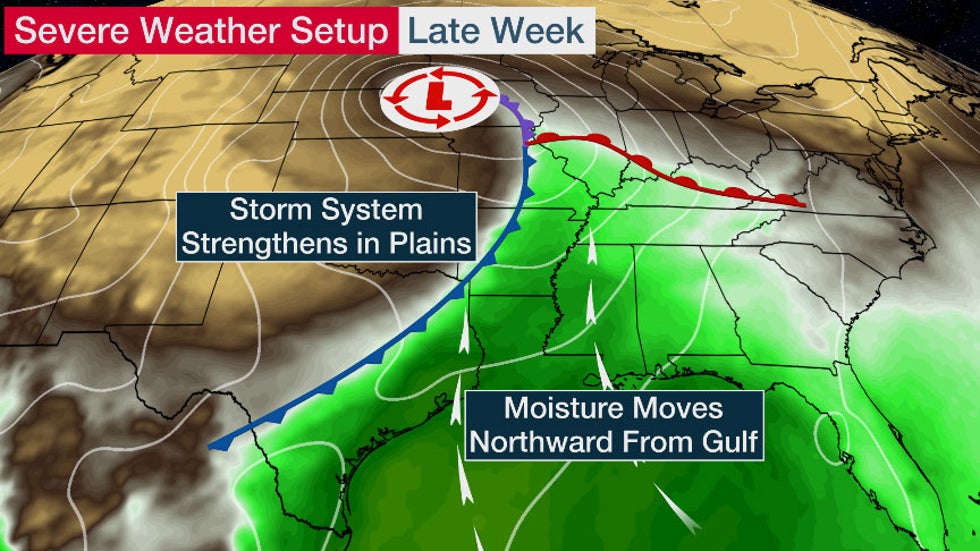
Severe weather setup into this weekend.
Severe thunderstorms could develop in parts of the South Saturday from a powerhouse storm system moving through the Plains states.
Southerly winds ahead of the storm will help draw moisture northward from the Gulf of Mexico into the lower Mississippi Valley That moisture, in tandem with strong winds in the upper atmosphere, will help trigger the development of numerous showers and thunderstorms.
Scattered severe storms will be possible from the Lower Mississippi Valley eastward to the Deep South. These storms may be capable of damaging winds and a tornado or two.
Current Radar, Watches and Warnings
Saturday morning, a wind gust of 67 mph was measured in Wills Point, Texas, where roof damage was reported.
Hail up to 2 inches in diameter (hen egg size) was reported near Iola, Oklahoma, Friday evening and golf-ball size hail fell near Pryor, Oklahoma.

Tuesday's Severe Weather Recap

Tornado warnings were issued Tuesday night in association with severe thunderstorms in Arkansas, Louisiana and MIssissippi.
Two people were reportedly injured just north of Baskin, Louisiana, when a trailer rolled in high winds caused by an EF2 tornado around 6 p.m. CST. Several other homes in the area were damaged, according to a preliminary report from NOAA's Storm Prediction Center. Radar indicated a tornado in the area at the time, with a debris signature aloft.
Another EF2 tornado was confirmed by NWS Jackson, MS, Wednesday afternoon in Star, Mississippi. Several other tornadoes are being surveyed, as of Wednesday afternoon.
The Weather Company’s primary journalistic mission is to report on breaking weather news, the environment and the importance of science to our lives. This story does not necessarily represent the position of our parent company, IBM.
The Weather Company’s primary journalistic mission is to report on breaking weather news, the environment and the importance of science to our lives. This story does not necessarily represent the position of our parent company, IBM.
Intense Winter Storm Snarls Traffic Along Highways in Plains; 1 Dead in South Dakota

Jonathan Belles and Jan Wesner ChildsPublished: November 30, 2019


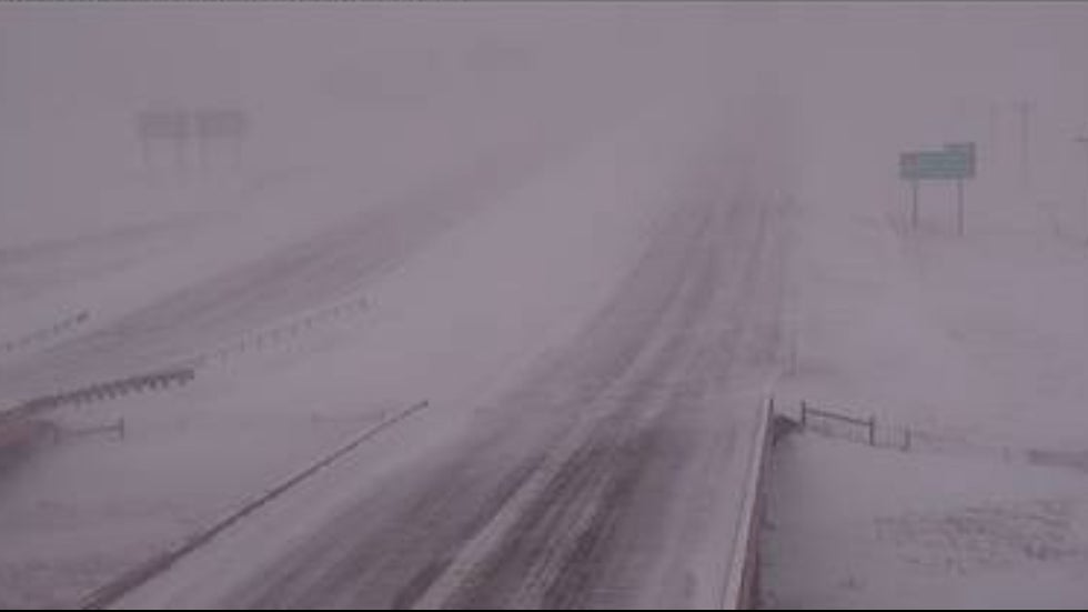
Blizzard conditions stopped traffic on Interstate 90 near Rapid City, South Dakota, Saturday evening.
A winter storm has snarled holiday traffic in parts of the Plains and Midwest after closing roads in the West earlier this week and has caused a town in Arizona to declare an emergency.
One person was killed in a rollover accident near Cavour, South Dakota, or just northwest of Sioux Falls, early Friday morning. The pickup truck lost control on an ice covered road and went into the a ditch and rolled. Both people in the truck had to be removed from the truck by authorities, but neither were wearing seat belts, according to KELO.
People were advised not to travel in much of western South Dakota. Rapid City, South Dakota, canceled its Festival of Lights Parade scheduled for Saturday evening due to the high winds, and much of the parade route had not been plowed, KELO reported.
The Rapid City, South Dakota, airport closed Saturday afternoon after visibility dropped so low that crews were unable to plow and use equipment.
In Minnesota, two lanes of I-94 near Moorhead was closed Saturday afternoon following a multi-vehicle accident involving at least one semitrailer.
Farther east, the city of Duluth, Minnesota, issued a "no travel advisory" beginning Saturday afternoon, according to the Associated Press. The National Weather Service reported blizzard conditions at the head of Lake Superior with snow falling at a rate of 1 inch per hour and winds gusting above 50 mph. NWS said huge waves were crashing onshore causing lake shore flooding.
Strong winds and blowing snow created dangerous travel conditions in parts of western Nebraska and portions of Interstate 80 are closed as of Saturday afternoon Both directions of I-80 are closed from the Wyoming/Nebraska state line to Sidney.
Travel across the Nebraska panhandle was ill-advised, and in fact, the Highway Patrol said it was closed early Saturday afternoon.
Portions of I-80 in Wyoming are also closed from the Nebraska border to east of Cheyenne. No unnecessary travel is recommended in much of eastern Wyoming.
Travel is also discouraged in parts of Colorado as blowing snow and gusty winds have closed some roads as of Saturday afternoon, including Interstate 25 north of Fort Collins, Highway 93 between Boulder and Golden, as well as Highway 287 and Highway 85 near the Wyoming border.
Flight Aware listed more than 100 canceled flights and nearly 240 delayed flights at Denver International by early Saturday afternoon.
Breckenridge Ski Resort, the Arapahoe Basin and the Loveland ski area closed a handful of lifts due to high winds Saturday. The Eldora Ski Area was closed due to extreme winds.

Western Impacts

Tusayan, Arizona, declared a state of emergency due to heavy snow and lack of electricity Friday. Tusayan is located near the Grand Canyon National Park where over a foot of snow has been measured.
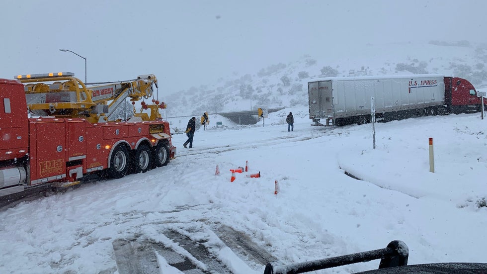
Crews clearing vehicles from the Southern California mountains.
shelter has been setup in the Grand Canyon National Park to assist the more than 1,000 people who have not had heat or power since early Friday. Roads are reported to be impassable and there are fuel shortages.
Parts of Interstate 40 and Interstate 17 were closed south of Flagstaff, Arizona, in both directions early Friday due to heavy snow in the higher elevations, according to the Arizona Department of Transportation. Several other roads were closed Friday morning in northern Arizona due to snow. The interstates were reopened midday Friday.
The National Weather Service noted Friday morning that travel was not recommended due to the heavy and blowing snow through at least midday. The Flagstaff area reported 8 to 12 inches of snowfall as of early Friday, with 15 inches measured at the Grand Canyon (South Rim).
In California, a portion of Interstate 5 from Grapevine to Castaic through Tejon Pass closed Thursday morning as heavy snow sweeps through the higher elevations. Snow gates were opened on I-5 near Santa Clarita to force northbound cars back southbound and down in elevation. Southbound lanes fully reopened Thursday afternoon. Several other major routes through Southern California are also closed.
The unusually intense winter storm downed trees, knocked out power and closed highways in parts of California Wednesday.
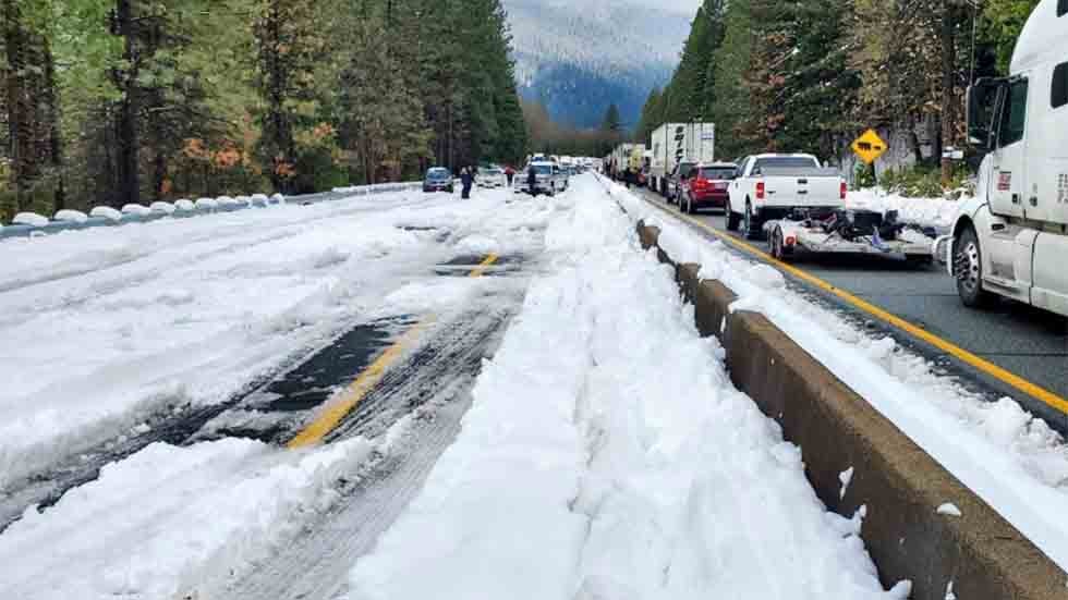
Motorists on Interstate 5 in Northern California reported being stuck on the road for hours and some spent the night in their cars, The Associated Press reported.
The California Department of Transportation and California Highway Patrol work to reopen a stretch of Interstate 5 in the northern part of the state on Wednesday, Nov. 27. 2019, after a winter storm caused multiple motor vehicle accidents and traffic backups.
Christina Williams of Portland, Oregon, told the AP that it took her and her 13-year-son 17 hours to reach Redding, California, a journey that would normally take 10 hours.
Williams told the AP she and other stranded drivers used weather-related hashtags to connect on the social media platform Twitter and share information on road conditions. Williams described “spin-outs everywhere” and abandoned trucks.
"There were spin-outs everywhere, there were trucks that were abandoned and every time we stopped and started moving again, there were people who couldn't start moving again," she said. "Every time we stopped I was like, is this it? Are we going to be here overnight?"
About 100 miles of Interstate 5 between Yreka and Redding near the Oregon border was closed Tuesday night and into early Wednesday morning due to multiple vehicle spinouts, according to the California Department of Transportation. The southbound lanes reopened Wednesday morning. The northbound lanes reopened heading from Redding, California, all the way to the Oregon border Wednesday evening.
Authorities were working to remove "the extremely large number of vehicles" off the road.
"Those vehicles must be removed in order to get traffic flowing normally and the road plowed," Caltrans tweeted earlier in the day.
The southbound portion of the interstate was also shut down from Ashland, Oregon, due to the conditions in Northern California, but has reopened.
The westbound lanes of Interstate 80 between Truckee and Nyack were also closed Wednesday morning due to multiple spinouts, the California Highway Patrol said. The roadway later reopened to passenger vehicles only.
The Placer County Sheriff's Office posted video of whiteout conditions in North Lake Tahoe.
Several other state highways in Northern California were closed or down to one lane overnight and into Wednesday morning due to snow, ice or trees blocking the roadway, Caltrans said. Highway 20 in Nevada County was closed near the intersection of I-80 due to whiteout conditions and excessive snow, and Highway 49 was closed between Downieville and Sattley in Sierra County.
Winter storm warnings were in effect across much of the region. The National Weather Service in Sacramento said travel was highly discouraged. The NWS advised travelers to be prepared for major delays and near-whiteout conditions in some areas. The worst impacts were expected today across the northern Sierra Nevada.
"The timing is unfortunate for holiday travel because it's going to have a lot of wintry impacts," Kevin Durphee, a meteorologist with the National Weather Service, told KFSN-TV.
The NWS in Eureka warned that rain and hail were making roads slippery.
More than 76,000 homes and businesses were without power in California Wednesday morning, according to PowerOutage.us. Many of the outages were caused by high winds.
The storm met the criteria for a bomb cyclone as it moved toward the coasts of Northern California and southern Oregon on Tuesday, meaning its pressure dropped rapidly. The Weather Channel has named the system Winter Storm Ezekiel.
The storm's impacts started Tuesday and continued overnight, with snow, rain and heavy winds.
Authorities asked travelers to practice care when driving and check road conditions before heading out.
"There's going to be a lot of extra vehicles on the roadway," Shasta Tollefson with the California Highway Patrol told KFSN. "Give yourself plenty of time when you are heading out the door, and if you have a normal four-hour travel time, make sure that you give yourself six hours."
The Weather Company’s primary journalistic mission is to report on breaking weather news, the environment and the importance of science to our lives. This story does not necessarily represent the position of our parent company, IBM.

The Weather Company’s primary journalistic mission is to report on breaking weather news, the environment and the importance of science to our lives. This story does not necessarily represent the position of our parent company, IBM.

Post-Thanksgiving Travel Headaches Are Expected as Two Systems Impact the U.S.

weather.com meteorologistsPublished: November 30, 2019


Thanksgiving travel delays are likely through the weekend as multiple storm systems track across the country with rain, snow and wind.
More than 55 million travelers are expected to travel 50 miles or more from their homes for the holiday, according to AAA. This makes it the second-highest Thanksgiving travel volume since AAA began tracking in 2000, behind only the record set in 2005.
Here is our latest thinking on the forecast through the holiday weekend.

Sunday's Outlook

Winter Storm Ezekiel will move into the East as a second area of low pressure develops off the Northeast coast. Another system will remain near the West Coast.
Travel Concerns: Travel delays in the form of wet or snow-covered roads and flight delays are likely from the Midwest to New England and into the Southeast. Rain may cause more travel headaches in California.
Northeast: Snow is forecast in parts of the region, particularly from New York state into New England. The precipitation will likely fall as rain in the mid-Atlantic states. A mix of snow, sleet, freezing rain and rain is anticipated in between those two areas. Some major hubs will be affected by weather, including Boston and New York City.
South: Rain is expected in the Southeast, especially early in the day, leading to wet roadways.
Midwest: Lingering snow and rain may cause travel issues in the Midwest and Great Lakes, but it should be a dry day in the Plains.
West: Snow remains possible in parts of the Sierra Nevada, with rain at lower elevations of Northern and Central California. A few rain or snow showers will spread into the Pacific Northwest as well. Snow showers are also possible in parts of the Great Basin.
Sunday's Forecast
The Weather Company’s primary journalistic mission is to report on breaking weather news, the environment and the importance of science to our lives. This story does not necessarily represent the position of our parent company, IBM.

The Weather Company’s primary journalistic mission is to report on breaking weather news, the environment and the importance of science to our lives. This story does not necessarily represent the position of our parent company, IBM.
Typhoon Kammuri to Track Through the Philippines Early Next Week With Dangerous Flooding, Storm Surge, Winds

Linda LamPublished: November 30, 2019


Typhoon Kammuri, know locally as Tisoy, will strengthen as it tracks westward toward the Philippines and may be the equivalent of a major hurricane when it makes landfall early next week.
Kammuri is currently tracking generally toward the west, and this motion is expected to continue this weekend.
Conditions will be favorable for intensification over the next few days and Kammuri will likely strengthen to the equivalent of a Category 3 hurricane.
Weakening will begin once it reaches the Philippines due to interaction with land, as well as an increase in dry air.
Landfall is expected late Monday or early Tuesday, local time.
Current Storm Status and Projected Path
Significant storm surge, along with damaging winds, flooding rain and mudslides will accompany Kammuri as it slams the Philippines.
A widespread area of more than 6 inches of rainfall into midweek is expected, with the highest rainfall totals expected in southeastern Luzon. This is also where storm surge will be a concern and where the highest winds will likely occur.
Heavy rainfall is also expected farther west, including in the Manila area.
Rainfall Forecast
Philippine Atmospheric, Geophysical and Astronomical Services Administration (PAGASA) notes that those living in areas identified to be highly susceptible to flooding and rain-induced landslides should take appropriate actions and continue to monitor for updates.
Typhoon Kammuri could delay or cancel some outdoor events at the Southeast Asian Games that begin this weekend, according to ABS-CBN News.
Kammuri will then move into the South China Sea by Thursday but should continue its weakening trend.
The Weather Company’s primary journalistic mission is to report on breaking weather news, the environment and the importance of science to our lives. This story does not necessarily represent the position of our parent company, IBM.
The Weather Company’s primary journalistic mission is to report on breaking weather news, the environment and the importance of science to our lives. This story does not necessarily represent the position of our parent company, IBM.

2 Kids Found Dead After Vehicle Swept Away by Floodwaters in Central Arizona

Associated PressPublished: November 30, 2019


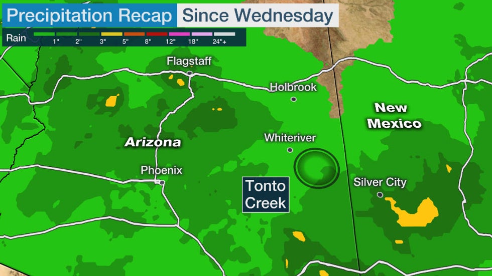
Two children have been found dead and one more is missing after the vehicle they were in was swept away by floodwaters in Arizona's Tonto National Forest on Friday.
Gila County sheriff’s Lt. Virgil Dodd said the first body found was of a 5-year-old boy. The second dead child’s age and gender weren’t provided in a statement released by the Sheriff’s Office.
Emergency personnel and law enforcement helicopters rescued two adults and two children on Friday, who also were in the vehicle swept away in Tonto Creek. They were rescued from a small island and the bank of the creek in Tonto National Forest northeast of Phoenix.
The Gila County Sheriff’s Office says the truck was swept away after trying to cross a creek that was closed around 4 p.m. Friday.
Sheriff’s Deputy Phil Smith told azfamily.com that the Sheriff’s Office closed the creek crossing and others in the area several hours before the vehicle tried to cross.
Dodd said authorities don’t know why the truck’s driver ignored barricades and warning signs at the closed crossing.
An intense winter storm brought heavy rain, flooding and tornadoes to central and southern Arizona while northern Arizona was slammed with heavy snow. The Weather Channel has named the system Winter Storm Ezekiel.
Smith said the creek only flows during storm runoff.

The Weather Company’s primary journalistic mission is to report on breaking weather news, the environment and the importance of science to our lives. This story does not necessarily represent the position of our parent company, IBM.

Three Unusual Tornadoes Confirmed in Arizona Friday

Linda LamPublished: November 30, 2019


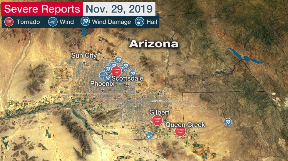
Three tornadoes were confirmed in Arizona on Nov. 29, 2019.
Three tornadoes developed in the Phoenix, Arizona, area early Friday as a powerful storm system moved through the West.
This was the third time since 1950 that three tornadoes were observed on the same day in Maricopa County. This is also the latest in the year that multiple tornadoes have occurred in Maricopa County, according to the National Weather Service.
Tornado warnings were issued early Friday morning and the first tornado developed just before 4 a.m. MST in Paradise Valley. This tornado tracked into northwest Scottsdale and has been rated EF1. Numerous trees were downed and roofs were damaged.
A second tornado formed near Higley and has been rated EF0. Small trees were damaged.
The third tornado was in the Queen Creek area just before 5 a.m. MST and has also been given a rating of EF0.
Tornado warnings are unusual for Arizona, according to Bianca Hernandez, a meteorologist with the National Weather Service in Phoenix.
Strong winds during the thunderstorms downed trees across the area early Friday morning. Wind gusts over 60 mph were measured in Paradise Valley and Glendale just before 4 a.m. MST.
The severe storms were part of a powerful low pressure system that also brought heavy snow to northern Arizona after disrupting travel in California earlier in the week.
The Weather Company’s primary journalistic mission is to report on breaking weather news, the environment and the importance of science to our lives. This story does not necessarily represent the position of our parent company, IBM.

The Weather Company’s primary journalistic mission is to report on breaking weather news, the environment and the importance of science to our lives. This story does not necessarily represent the position of our parent company, IBM.

Intense Winter Storm Snarls Traffic Along Major Travel Routes in California

Jan Wesner ChildsPublished: November 28, 2019


Crews clearing vehicles from the Southern California mountains.
A winter storm is now snarling holiday traffic across southern California after stopping traffic across Northern California.
A portion of Interstate 5 from Grapevine to Castaic, California, through Tejon Pass closed Thursday morning as heavy snow sweeps through the higher elevations. Snow gates were opened on I-5 near Santa Clarita to force northbound cars back southbound and down in elevation. Southbound lanes fully reopened Thursday afternoon. Several other major routes through Southern California are also closed.
The unusually intense winter storm downed trees, knocked out power and closed highways in parts of California Wednesday.
Motorists on Interstate 5 in Northern California reported being stuck on the road for hours and some spent the night in their cars, The Associated Press reported.
The California Department of Transportation and California Highway Patrol work to reopen a stretch of Interstate 5 in the northern part of the state on Wednesday, Nov. 27. 2019, after a winter storm caused multiple motor vehicle accidents and traffic backups.
Christina Williams of Portland, Oregon, told the AP that it took her and her 13-year-son 17 hours to reach Redding, California, a journey that would normally take 10 hours.
Williams told the AP she and other stranded drivers used weather-related hashtags to connect on the social media platform Twitter and share information on road conditions. Williams described “spin-outs everywhere” and abandoned trucks.
"There were spin-outs everywhere, there were trucks that were abandoned and every time we stopped and started moving again, there were people who couldn't start moving again," she said. "Every time we stopped I was like, is this it? Are we going to be here overnight?"
About 100 miles of Interstate 5 between Yreka and Redding near the Oregon border was closed Tuesday night and into early Wednesday morning due to multiple vehicle spinouts, according to the California Department of Transportation. The southbound lanes reopened Wednesday morning. The northbound lanes reopened heading from Redding, California, all the way to the Oregon border Wednesday evening.
Authorities were working to remove "the extremely large number of vehicles" off the road.
"Those vehicles must be removed in order to get traffic flowing normally and the road plowed," Caltrans tweeted earlier in the day.
The southbound portion of the interstate was also shut down from Ashland, Oregon, due to the conditions in Northern California, but has reopened.
The westbound lanes of Interstate 80 between Truckee and Nyack were also closed Wednesday morning due to multiple spinouts, the California Highway Patrol said. The roadway later reopened to passenger vehicles only.
The Placer County Sheriff's Office posted video of whiteout conditions in North Lake Tahoe.
Several other state highways in Northern California were closed or down to one lane overnight and into Wednesday morning due to snow, ice or trees blocking the roadway, Caltrans said. Highway 20 in Nevada County was closed near the intersection of I-80 due to whiteout conditions and excessive snow, and Highway 49 was closed between Downieville and Sattley in Sierra County.
Winter storm warnings were in effect across much of the region. The National Weather Service in Sacramento said travel was highly discouraged. The NWS advised travelers to be prepared for major delays and near-whiteout conditions in some areas. The worst impacts were expected today across the northern Sierra Nevada.
"The timing is unfortunate for holiday travel because it's going to have a lot of wintry impacts," Kevin Durphee, a meteorologist with the National Weather Service, told KFSN-TV.
The NWS in Eureka warned that rain and hail were making roads slippery.
More than 76,000 homes and businesses were without power in California Wednesday morning, according to PowerOutage.us. Many of the outages were caused by high winds.
The storm met the criteria for a bomb cyclone as it moved toward the coasts of Northern California and southern Oregon on Tuesday, meaning its pressure dropped rapidly. The Weather Channel has named the system Winter Storm Ezekiel.
The storm's impacts started Tuesday and continued overnight, with snow, rain and heavy winds.
Authorities asked travelers to practice care when driving and check road conditions before heading out.
"There's going to be a lot of extra vehicles on the roadway," Shasta Tollefson with the California Highway Patrol told KFSN. "Give yourself plenty of time when you are heading out the door, and if you have a normal four-hour travel time, make sure that you give yourself six hours."
The Weather Company’s primary journalistic mission is to report on breaking weather news, the environment and the importance of science to our lives. This story does not necessarily represent the position of our parent company, IBM.

The Weather Company’s primary journalistic mission is to report on breaking weather news, the environment and the importance of science to our lives. This story does not necessarily represent the position of our parent company, IBM.

Man missing at sea for nearly 2 weeks found alive in life raft off Washington coast

  One of two men missing at sea for nearly two weeks was found alive on Thursday by a Canadian fishing boat in a life raft in Canadian water...