As of 2:45 p.m. EDT Thursday, this live blog is no longer being updated. For continued live coverage of Dorian, click here.
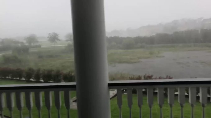
As Dorian tracked closer to the Carolina coast Thursday, heavy winds and bands of rain triggered severe coastal flooding as reports of tornadoes increased.
The storm is crawling northward at a speed of about 8 mph and is located about 55 miles east of Charleston, South Carolina, as of 1 p.m. Thursday.
Even with Dorian being past its peak intensity, when it dealt a historic blow in the Bahamas as a Category 5 storm, forecasters say the current state of the storm should be not taken lightly.
Charleston city officials urged residents to shelter in place on Wednesday night as rain and wind intensified. Power outages were also mounting in the state, with tens of thousands without power early Thursday morning.
One person was reportedly injured in West Ashley, South Carolina, early Thursday morning when a tree fell on a home and caused structural damage, local media reported. The individual was transported to a hospital, with the extent of injuries unknown at this time.
The first storm-related death on U.S. soil was reported by North Carolina Governor Roy Cooper in a press conference early Wednesday morning. The victim was an 85-year-old man from Columbus County, North Carolina, who fell from a ladder while preparing his home for the storm. In the Bahamas, the death toll rose to at least 20 people, as residents still process the devastation.
(Twitter/@NWSMoreheadCity)
1/33
The National Weather Service identified a waterspout off the coast of Emerald Isle, North Carolina, on Thursday morning, Sept. 5, 2019, as Dorian skirted along the southeastern U.S. coast.
Winds have been increasing along the South and North Carolina coasts as Dorian approaches. Wind gusts as high as 54 mph were recorded in Charleston, South Carolina, early Thursday morning.
Storm surge warnings remain in effect from northeast Florida to Virginia, while weather buoys in the ocean have recorded significant waves. A wave at 14.8 feet was detected off the coast of St. Augustine on Wednesday morning while other buoys off the coast of Georgia picked up waves at 8.9 feet and 10.8 feet.
On Tuesday night, a buoy off the shore of Melbourne, Florida, reported wind gusts of 90 mph with waves up to 32 feet.
The waves and currents have been just as dangerous close to the shoreline, threatening to sweep away anyone who dared to get too close. The Jacksonville Sheriff's Office tweeted that a lifeguard had to save woman who had been standing on the shore of Neptune Beach, Florida, had been knocked down and pulled into the ocean by a current.

Airlines have also felt the punch from Dorian, as more than 4,000 total flights have been canceled this week. Officials from the Charleston International Airport in South Carolina made the decision to close at 3 p.m. on Wednesday.
In the Carolinas, residents of coastal communities have continually been advised to evacuate as multiple counties along the coast have declared a state of emergency. AccuWeather Chief Broadcast Meteorologist Bernie Rayno said there is a “strong likelihood of a landfall anywhere between Myrtle Beach, South Carolina, and Cape Hatteras, North Carolina.”
“Flood risks are the greatest over the coastal Carolinas,” AccuWeather Broadcast Meteorologist Justin Povick said. “We’re talking about an AccuWeather Local StormMax™ of 15 inches of rain, and this will cause widespread, dangerous flooding.”
Coastal counties in the Carolinas such as Wrightsville Beach, North Carolina have issued mandatory evacuations to prepare for the threat of landfall. North Carolina Gov. Roy Cooper warned residents in a press conference on Wednesday that time was running short as the storm crawls closer toward the state.
RELATED:
2:30 p.m. EDT Thursday:
“We are calling for voluntary evacuation for those areas of the city that traditionally are impacted by mayor northeastern storms, northeasters and tropical storms…,” said in a press conference Tom Leahy, Virginia Beach Interim City Manager, as he announces a mandatory evacuation for citizens in Sandbridge effective 6 p.m. on Thursday.
2:00 p.m. EDT Thursday:
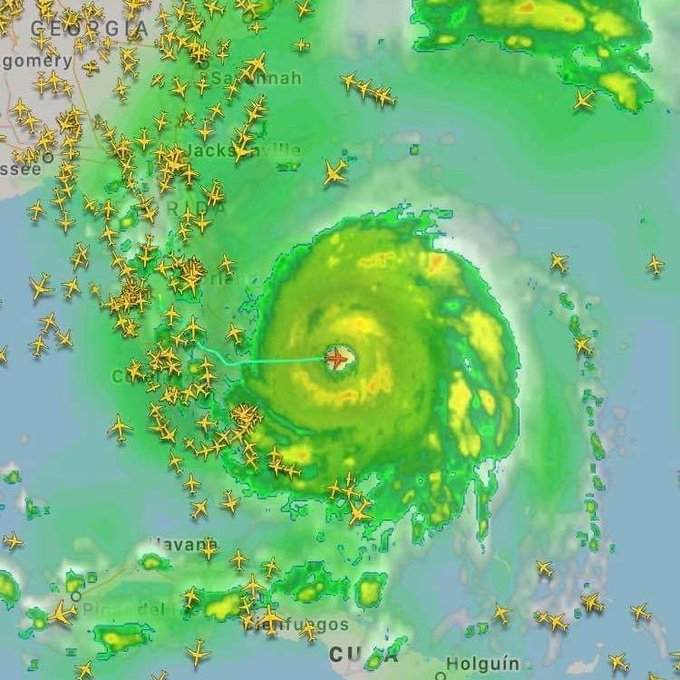
FUN FACT ALERT 🚨: When a hurricane approaches, all air traffic deviates from the storm, except hurricane hunters from NOAA and the Air Force Reserve.
1:45 p.m. EDT Thursday:
The U.S. Army Corps of Engineers announced on its Twitter page that approximately $18 million is being assigned to cover regional activation, temporary emergency power, temporary housing, and temporary roofing , among other issues that are related to the Dorian emergency.
12:37 p.m. EDT Thursday:
Just after noon on Thursday, more than 250,000 residents in South Carolina were now without power due to Hurricane Dorian, according to poweroutage.us.
At least 10,000 others in Georgia and Florida also found themselves without power.
According to Santee Cooper, a company that provides electricity to customers in Berkley, Georgetown and Horry counties, utility crews were forced to scale back their recovery efforts as heavy winds picked up.
12:22 p.m. EDT Thursday:
In North Carolina, police officers criminally charged numerous people for not following mandatory evacuation orders, according to Wrightsville Beach Police Chief Dan House. Numerous areas of the city were heavily damaged today by a tornado touching down at the Boardwalk RV Park.
Heavy rain, tornado warnings and flash flood warnings have inundated the area. Flood concerns are particularly notable for areas around Horry County, where river flooding is a likely danger.
11:09 a.m. EDT Thursday:
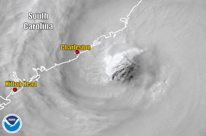
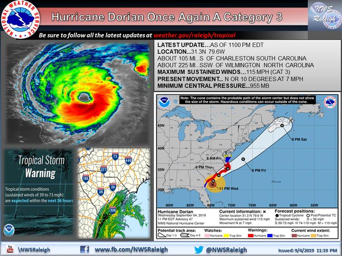
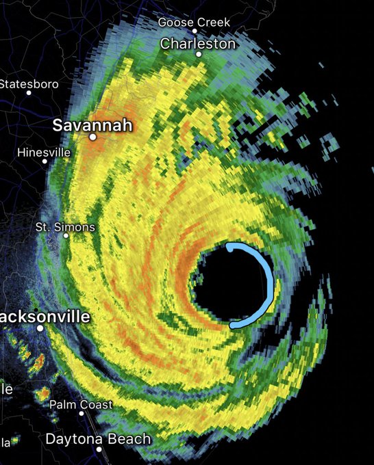
Hurricane Dorian weakened back down to a Category 2 storm with maximum sustained winds of 110 mph and continued to move north-northeast at 8 mph. NOAA satellites captured imagery of how close the eye came to Charleston, South Carolina -- just 50 miles.
11:05 a.m. EDT Thursday:
There have been 10 tornadoes reported on South Carolina and North Carolina over the past 24 hours as Hurricane Dorian closed in. Tornado watches remained in place for all coastal regions in both states.

10:25 a.m. EDT Thursday:
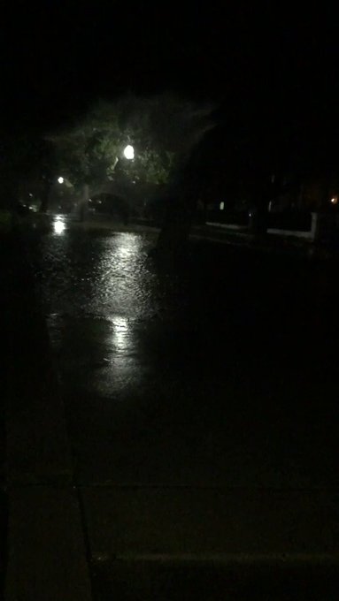
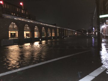
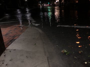
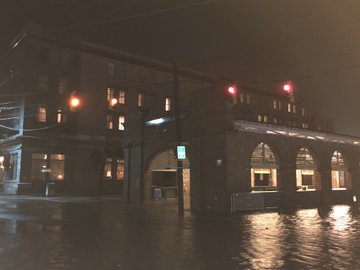
At Fort Sumter in Charleston, South Carolina, a 74 mph wind gust was recently recorded. Elsewhere in the city, Church Creek is nearly at minor flood stage while the city's downtown finds itself under water, forcing dozens of road closures.
9:59 a.m. EDT Thursday:
Some rainfall totals of 3 to 6 inches are being recorded across the Charleston, South Carolina, area, with a high of 7.09 inches recorded by a gauge in Mount Pleasant.
All of this has occurred in low tide. High tide will move in around 2 p.m., EDT.
8:02 a.m. EDT Thursday:
More than 200,000 in South Carolina are now without power, according to poweroutage.us. Over 100,000 of those outages come from Charleston. in Georgia, more than 15,000 residents are also without power.
7:48 a.m. EDT Thursday:
There have been four reported tornado sightings in the Carolinas thus far as Dorian's eye is making a northeastward shift: two in Horry County, South Carolina, and one in Columbus County and Brunswick County, North Carolina.
Videos have also emerged of a tornadoes in Myrtle Beach, South Carolina and Wilmington, North Carolina. The National Weather Service office in Wilmington reported the tornado passing by around 7:00 a.m. and a tornado warning for the region was put in place.
7:37 a.m. EDT Thursday:
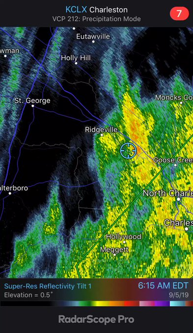
Heavy rain bands from Hurricane Dorian have sparked flooding throughout South Carolina in Charleston, North Charleston, Mount Pleasant, Goose Creek, Hanahan, McClellanville, Edisto Beach and Middleton Place. The Church Creek gauge reported a stage height of 5.6 feet and rising.
Dorchester County, South Carolina, has reported widespread power outages due to downed trees.
7:03 a.m. EDT Thursday:
Tornado warnings in North Carolina have been put in place for White Lake, Kelly, East Arcadia, Hampstead, Rocky Point and Saint Helena, according to National Weather Service.
At the 7:00 a.m. National Hurricane Center update, Dorian remains about 80 miles off the coast of Charleston, South Carolina.
6:08 a.m. EDT Thursday:
Heavy wind is also now being reported in North Carolina, as a 64-mph gust was recently reported south of Kure Beach, North Carolina, according to the National Hurricane Center. Dorian's maximum sustained winds are holding steady at 115 mph.
5:00 a.m. EDT Thursday:
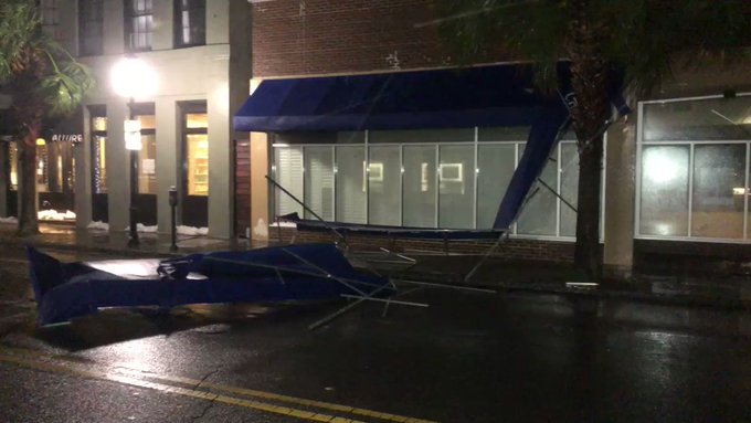
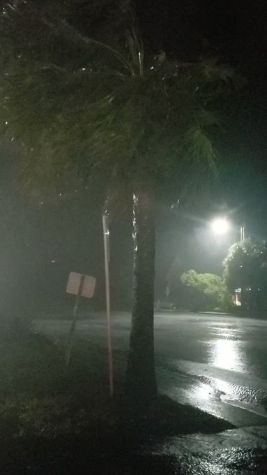
A wind gust of 68 mph has been recorded at the Charleston Airport in South Carolina. These strong winds are bringing down trees and power lines as well as causing damage to some structures. Power outages have now exceeded 106,000 statewide, according to poweroutage.us.
4:25 a.m. EDT Thursday:
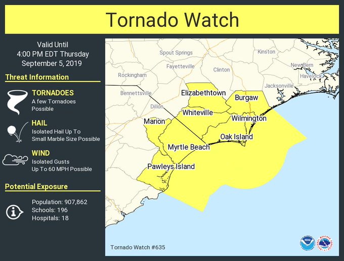
A tornado watch has been issued for parts of coastal South and North Carolina. The watch is in effect until 4 p.m. EDT Thursday. Myrtle Beach, South Carolina, and Wilmington, North Carolina, are included in this watch, so people in these areas should remain vigilant throughout the day for thunderstorms capable of producing tornadoes.
A flash flood warning has also been issued for a large part of the central South Carolina coast.
"As much as 4 inches of rain has fallen since Wednesday afternoon, with heavier rain bands from Dorian expected to bring as much as 1 to 2 inches per hour through this morning. Flash flooding is expected to begin shortly. Church Creek in West Ashley is expected to experience flash flooding, as well as Downtown Charleston," the National Weather Service said.
4:15 a.m. EDT Thursday:
Fifty roads are closed in the city of Charleston, South Carolina, due to flooding from a combination of heavy rainfall and storm surge, according to local emergency management.
In addition to flooding, the risk of tornadoes is mounting. Myrtle Beach, South Carolina, remains under a tornado warning until 4:45 a.m. EDT Thursday, according to the National Weather Service.
3:25 a.m. EDT Thursday:
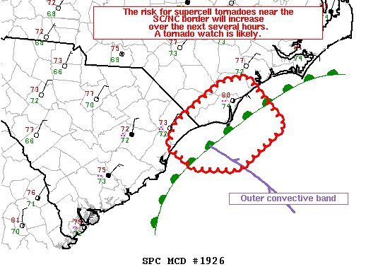
The National Weather Service Storm Prediction Center says that a tornado watch will likely be put into effect in southeastern South Carolina and southwestern North Carolina over the next few hours. The probability of a watch being issued is 80%.
3:00 a.m. EDT Thursday:
One person was reportedly injured in West Ashley, South Carolina, early Thursday morning when a tree fell on a home and caused structural damage, local media reported. The individual was transported to a hospital, with the extent of their injuries unknown at this time.
The NHC has issued an updated advisory for Dorian, stating that water levels are gradually rising along portions of the South Carolina coast as the hurricane moves closer. The center of Dorian is located about 100 miles from Charleston, South Carolina.
2:30 a.m. EDT Thursday:
The Charleston, South Carolina, Police Department has issued a Code Yellow for all bridges due to 35 mph winds. This means that "high-profile vehicles will be advised not to use high span (65 feet or higher) or exposed bridges, and the public should use extreme caution if they decide to travel over bridges."
The department is also telling residents to shelter in place due to the deteriorating conditions.
Power outages continue to mount in the state, with now over 35,000 customers in the dark, according to poweroutage.us.
1:25 a.m. EDT Thursday:
The Charleston, South Carolina, Police Department said on Twitter that emergency crews "are fully deployed throughout the city and responding to flooding, downed trees, and other storm related incidents. They will continue to respond throughout the night, as long as conditions allow."
A news reporter for a local television station in Charleston was on the scene at Market Street where the roadway was completely underwater.
Power outages are mounting across the state of South Carolina, with over 20,000 customers in the dark, according to poweroutage.us.
Meanwhile, Royal Caribbean has announced that its ship Empress of the Seas will be making a detour to deliver relief items to Grand Bahama Island ahead of its planned stop in Nassau.
12:30 a.m. EDT Thursday:
The National Hurricane Center (NHC) reports that a weather station on the north end of Folly Island, South Carolina, recorded a sustained wind of 51 mph and a gust of 62 mph.
The NHC also said that all watches and warnings for the east coast of Florida south of the Mouth of St. Mary's River have been discontinued.
11:05 p.m. EDT Wednesday:
The National Hurricane Center's latest advisory on Dorian states that the hurricane has reached Category 3 strength once again. Maximum sustained winds are now 115 mph as the center of the storm lies 105 miles south of Charleston, South Carolina.

10 p.m. EDT Wednesday:
Rain bands are spreading across South Carolina and North Carolina Coasts ahead of Dorian.
The hurricane will continue moving northeast and pass only 20-30 miles off the coast of Wilmington, NC Thursday evening.
Moderate flooding from 6-10 inches of rain, a 4-8 foot storm surge and damaging tropical storm force winds with gusts over hurricane force are expected along parts of the coastal southeastern United States from Georgia to the Carolinas tonight through Friday morning.
Moderate flooding from 6-10 inches of rain, a 4-8 foot storm surge and damaging tropical storm force winds with gusts over hurricane force are expected along parts of the coastal southeastern United States from Georgia to the Carolinas tonight through Friday morning.
9 p.m. EDT Wednesday:
Hurricane Dorian is restrengthening and has the potential to attain Category 3 status again.
"Predecessor rain event has been ongoing all day just offshore eastern North Carolina with some likely water spouts as well as very heavy rain," AccuWeather's Extreme Meteorologist Reed Timmer reported. "If this ever can make it onshore it would cause major flash flooding problems."
8 p.m. EDT Wednesday:
"Life threatening storm surge with significant coastal flooding is expected along a large portion of the southeast and mid-Atlantic coasts of the US during the next couple of days," the National Hurricane Center said.
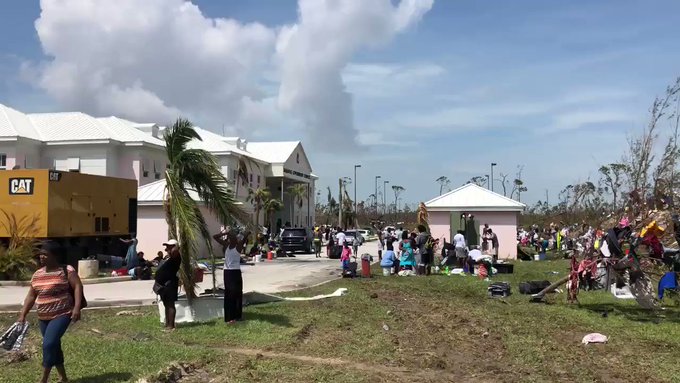
Following Dorian's wrath in the Bahamas, people are doing laundry and drying clothes in any place available. The hurricane death toll has climbed to 20 as residents in the Bahamas still process the devastation.
"People [are] crammed into an office building and doing laundry in buckets and drying clothes on trees and downed power lines," national reporter Jonathan Petramala said explaining the scene in the Bahamas. "Locals warn it’s on the edge of violence."
7 p.m. EDT Wednesday:
Dorian was packing 110-mph sustained winds and was about 130 miles south of Charleston.
According to the National Hurricane Center, wind gusts up to 49-mph have been measured at Folly Beach Pier, just south of Charleston, South Carolina.

Hurricane Dorian at 7:30 p.m. EDT on Wednesday. (GOES-East/NOAA)
6 p.m. EDT Wednesday:
The eye of Dorian was moving north-northwestward off the Georgia coast early Wednesday evening.
As the center of the storm closed in on Charleston, South Carolina, some homeowners there weren't taking any chances by leaving their residences vulnerable to flooding from Hurricane Dorian. Some homes in the city were fortified by 'the world's largest sandbags' -- which is a bit of a misnomer since they're not actually filled with sand.
As the center of the storm closed in on Charleston, South Carolina, some homeowners there weren't taking any chances by leaving their residences vulnerable to flooding from Hurricane Dorian. Some homes in the city were fortified by 'the world's largest sandbags' -- which is a bit of a misnomer since they're not actually filled with sand.
For previous reports on Dorian, click here.

















No comments:
Post a Comment