The corridor from western Texas to northern Missouri and Iowa will remain in the midst of a seemingly endless risk for severe weather and flooding downpours this Memorial Day holiday weekend.
Severe thunderstorms and downpours increased late Friday and continued through the night, with numerous reports of flash flooding, water rescues and road closures from central Oklahoma through northern Missouri.
In addition to the flooding, several tornadoes were reported from southeast Kansas to central Illinois and eastern Iowa as the week came to a close.
Much to the dismay of those with festivities planned, the holiday weekend will bring no reprieve from the violent weather.
"Yet another round of severe thunderstorms will fire Saturday during the late afternoon and evening from western Texas northward into Kansas, Missouri and southern Iowa," according to AccuWeather Senior Meteorologist Dan Pydynowski.
Another zone of severe storms will fire up from Illinois to Pennsylvania on Saturday.
RELATED:
Record-breaking floods inundate parts of central US
Dangerous storms to rumble from Illinois to Pennsylvania through Sunday
Tornadoes and travel: How to stay safe inside an airport or hotel
VIDEO: Windshield smashed by timber during tornado
Record-breaking floods inundate parts of central US
Dangerous storms to rumble from Illinois to Pennsylvania through Sunday
Tornadoes and travel: How to stay safe inside an airport or hotel
VIDEO: Windshield smashed by timber during tornado
The morning and midday hours will be the better times for outdoor activities on Saturday from Lubbock and Amarillo, Texas, to Garden City, Dodge City and Wichita, Kansas; Kansas City, Missouri; and Des Moines, Iowa; before the severe weather erupts later in the day.
Download the free AccuWeather app to stay alert to severe weather watches and warnings. Keep checking back for updates on AccuWeather.com and stay tuned to the AccuWeather Network on DirecTV, Frontier and Verizon Fios.

The worst of the severe weather on Saturday is expected to remain to the west of the hard-hit communities of Jefferson City and Golden City, Missouri. However, some rain and thunderstorms can dampen these cities at times Saturday into Saturday night, disrupting cleanup operations.
"In addition to the ongoing flood threat, the thunderstorms that fire Saturday afternoon into the evening can produce tornadoes, hail and damaging wind gusts," according to Pydynowski.

While it takes only one violent thunderstorm or tornado to cause damage, the most significant severe weather on Saturday may focus on the corridor from the Texas Panhandle to western Kansas.
There will be little time for storm cleanup in these areas as another bout of severe thunderstorms ignites from western Texas to Nebraska on Sunday afternoon and evening. Similar to Saturday, all modes of severe weather, including tornadoes, are anticipated.
Even in communities that escape damage from wind, hail or tornadoes, dangers to lives and property will still exist.
"Heavy rain and downpours from the rounds of severe weather will exacerbate the ongoing flooding which is occurring across large swaths of the Plains," Pydynowski said.
There can be an AccuWeather Local StormMax™ of 12 inches from north-central Oklahoma to far southeastern Nebraska and northwestern Missouri spanning Friday, May 24, through Sunday, May 26.
While the severe weather dangers will be greatest each afternoon and evening, the flood risk can last longer through the night and into the following morning.

A quick 1-2 inches of rain will easily trigger flash flooding in poor drainage and urban areas. Already swollen streams can surge back out of their banks with additional rises on larger rivers.
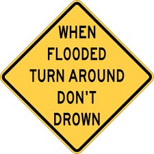
Residents living along waterways and in flood-prone areas should remain vigilant for additional evacuations. Officials may be forced to close more roads and bridges. Never drive through a flooded road.
Moderate to major river flooding is ongoing from northeastern Oklahoma and eastern Kansas to Missouri and Illinois. Wagoner County Emergency Management issued a voluntary evacuation notice for low-lying areas near the Arkansas and Verdigris rivers on Friday.
National Weather Service hydrologists warned of a dangerous and life-threatening situation as the Arkansas River near Ponca City, Oklahoma, soared above its previous record crest of 21.1 feet on Friday.

The river at Van Buren, Arkansas, is expected to rise at least 3 feet above the record of 38.10 feet from April 1945 this weekend.
Most of the downpours this holiday weekend will bypass Van Buren and Arkansas, but the river will keep rising as flood waters drain downstream.
Looking ahead to Memorial Day, an isolated severe thunderstorm erupting from western Texas to southwestern Kansas cannot be ruled out late in the day. Otherwise, most of the South Central states will welcome much-needed dry weather as rain and severe thunderstorms focus on the central Plains.
The severe weather risk may expand back southward on Tuesday.


No comments:
Post a Comment