A severe weather outbreak unfolded on Wednesday afternoon and night from Oklahoma to Illinois, producing devastating tornadoes that wreaked havoc in Missouri.
Three people were killed in Golden City, Missouri, while the state's capital, Jefferson City, took a direct hit from a massive ornado around 11:45 p.m. Wednesday. About 20 people were injured, but no fatalities were reported.
Click here for a full recap of the severe weather event. Scroll below to read real-time storm reports from Wednesday May 22 into Thursday May 23.
8:55 a.m. CDT Thursday:
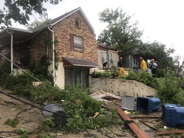
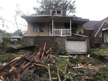
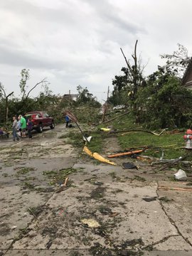
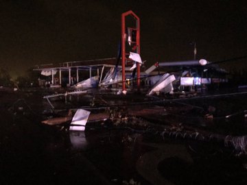
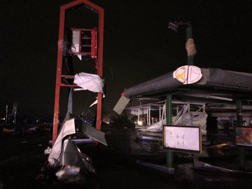
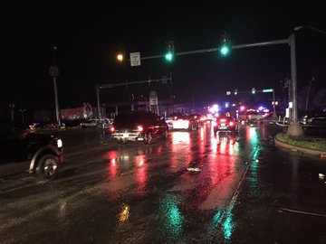
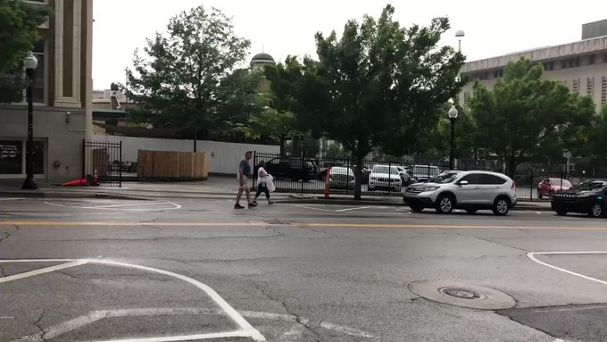
More photos of the widespread damage are emerging from the Jefferson City area. Emergency responders continue to urge residents to allow crews to do clean-up work.
8 a.m. CDT Thursday:
A look at the timeline of the Jefferson City tornado from Wednesday night.

Over 21,000 remain without power in Missouri at this hour, according to Poweroutage.us.
6:02 a.m. CDT Thursday:
The Jefferson City Police Department said the number of injured has risen to 20, but no fatalities have been reported in Jefferson City.
There are still concerns for the businesses located in the impacted area, according to a media release. The utilities in the damaged homes and businesses present a hazard as power is restored.
"Emergency personnel are continuing to contact displaced residents in the affected area. Citizens are urged to stay away from the impacted area to allow emergency personnel access," department officials said in a statement.
5:23 a.m. CDT Thursday:
The Missouri Department of Public Safety reports that at least nine people have been admitted to Jefferson City hospitals due to storm-related injuries. The agency is disputing reports that 100 people have been hospitalized.
Officials are also urging non-essential state employees who work in Jefferson City to not report to work on Thursday.
"There is damage to some state buildings, others need to be fully assessed and power is down in some areas. We will keep you posted," officials said on Twitter.
4:15 a.m. CDT Thursday:
A severe thunderstorm warning is in effect for Indianapolis. This line of storms had had a history of wind gusts to 70 mph, leading to downed trees and power lines.
2:45 a.m. CDT Thursday:
The Missouri State Highway Patrol's Troop F (MSHP Troop F) is assisting Jefferson City Police in cleanup efforts in Jefferson City, Missouri following a damaging tornado that swept through the area. They urge residents to avoid the area.
Below are some of the photos taken by MSHP Troop F of the damage:

One of the several vehicles on or near WB BUS 54 near Eldon, Missouri. (Twitter/MSHP Troop F)

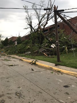
Trees and power lines are down after a tornado struck Jefferson City, Missouri, during Wednesday night. (Twitter/MSHP Troop F)
2:30 a.m. CDT Thursday:
A line of thunderstorms, which have a history of producing wind gusts between 70 and 80 mph, will move eastward into northern and central Indiana.

1:30 a.m. CDT Thursday:
A line of thunderstorms is crossing Illinois early Thursday morning. The main threat with this line will be damaging winds.
Multiple reports of downed trees and power lines have been reported within this line. A wind gust of 58 mph was reported at the Bloomington Airport.
On the northern side of this line, funnel clouds have been reported near Fairbury. A tornado warning remains in effect for the towns of Kempton and Cullom.

1:15 a.m. CDT Thursday:
Thunderstorms in northeastern Oklahoma will be capable of producing a tornado over the next few hours. A tornado was just recently reported near Bernice, Oklahoma. Wind gusts between 70 and 80 mph were also reported south of Afton, Oklahoma.
The future track of these thunderstorms will be to the south of Joplin, Missouri.

12:20 a.m. CDT Thursday:
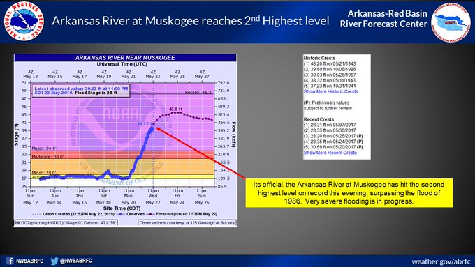
The Arkansas River at Muskogee has riven to major flood stage and is expected to continue rising into Thursday morning. It has not set a record for the second highest crest on record.
12:10 a.m. CDT Thursday:
The Jefferson City Fire Department is reporting people trapped in basements and in an apartment complex following a tornado that struck the state capitol. There are also multiple reports on social media of a Best Western hotel that got hit by the tornado with injuries inside.
Emergency dispatch has requested for assistance with the National Guard to assist those trapped or injured from the tornado.
11:45 p.m. CDT Wednesday:
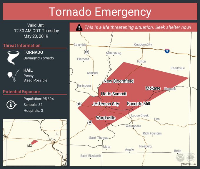
A tornado emergency is in effect for Jefferson City, Missouri, and surrounding areas. Take cover now! A tornado has been confirmed on the ground, according to the National Weather Service in St. Louis.
11:00 p.m. CDT Wednesday:
Three people have been confirmed dead from the tornado that struck Golden City, Missouri, according to the Lamar Police Chief and multiple sources.
10:30 p.m. CDT Wednesday:
Muskogee County emergency management has urged those in the town of Webbers Falls and nearby areas west of the Arkansas River to evacuate now! "Historic and life-threatening flooding is now occurring on the Arkansas River," they said. "Significant flooding in the town of Webbers Falls is imminent."
Those evacuating should move west and south along Highway 100 to Interstate 40 away from the Arkansas River.
9:55 p.m. CDT Wednesday:
A new thunderstorm may be producing a tornado to the north of Golden City, Missouri, which just got hit by a tornado less than one hour ago.

9:45 p.m. CDT Wednesday:
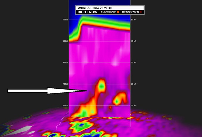
This image shows debris lofted over 20,000 feet in the air from the tornado that touched down in Orongo, Missouri, north of Joplin, earlier Wednesday evening.
9:30 p.m. CDT Wednesday:
A tornado caused major structural damage to the town of Golden City, Missouri, according to law enforcement. This is the same thunderstorm that passed near Joplin, Missouri, an hour prior.
A tornado warning remains in effect for this storm as it moves off to the northeast.
A trained spotter also observed a tornado on the ground just north of Columbia, Missouri.
9:00 p.m. CDT Wednesday:
Muskogee County officials confirm two barges broke loose on the Arkansas River. They are heading downstream and some fear they may hit the Webbers Falls Lock and Dam.
The town of Webbers Falls has been under a mandatory evacuation.
8:18 p.m. CDT Wednesday:
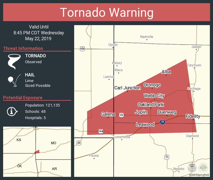
Particularly Dangerous Situation: A confirmed large and destructive tornado is located over Oronogo, near Joplin, Missouri moving northeast at 25 mph.
Significant damage reported at Fir Road and Black Cat Road on the south side of the Carl Junction area.

7:54 p.m. CDT Wednesday:
A spotter confirmed a large tornado near Baxter Springs, Kansas, which is just west of Joplin, Missouri.

7:36 p.m. CDT Wednesday:
AccuWeather Video Journalist Blake Naftel caught a large wedge tornado near Commerce, Oklahoma.
7:27 p.m. CDT Wednesday:
A large cone tornado was reported near Commerce, Oklahoma traveling northeast toward the Kansas border.
6:57 p.m. CDT Wednesday:
A tornado has been reported to the west of Bluejacket, Oklahoma traveling toward Welch.
Very strong wind gusts are expected from the severe thunderstorms into tonight. These storms will be capable of producing wind gusts in excess of 70 mph.
6:09 p.m. CDT Wednesday:
The National Weather Service in Tulsa, Oklahoma reported a tornado in northern Tulsa county just east on Sperry approaching Collinsville. Residents should take shelter immediately.
5:55 p.m. CDT Wednesday:
AccuWeather Reporter Jonathan Petramala reports sirens in Tulsa, Oklahoma as severe storms approach the area. Residents should be aware and alert in case of an emergency.
5:30 p.m. CDT Wednesday:
A severe thunderstorm with a confirmed tornado was near Okemah, Oklahoma, and was tracking northeast toward Okmulgee. The storm may also bring winds over 50mph and hail larger than golf balls.
There is also a report that a house may have been hit by the large tornado southwest of the town.

A large tornado near Okemah, Oklahoma, on Wednesday afternoon. (Twitter/Jeffrey Stevenson)

4:30 p.m. CDT Wednesday:
The first tornado of the day has been confirmed near Cromwell, Oklahoma, and is tracking northeast toward Okemah. People in the path of this twister need to seek shelter immediately.
4 p.m. CDT Wednesday:
A ‘particularly dangerous situation' tornado watch has been issued for part of north-central Texas, central Oklahoma, southeastern Kansas and southwestern Missouri. This includes Wichita Falls, Texas; Oklahoma City and Tulsa, Oklahoma; and Joplin, Missouri. Another tornado watch has been issued for northeastern Missouri and western Illinois.
“Several tornadoes and a few intense tornadoes are likely,” the Storm Prediction Center (SPC) said in the tornado watch.
A tornado watch means that conditions are favorable for tornado-producing thunderstorms to develop, while a tornado warning means that a tornado is imminent or is on the ground.

The University of Oklahoma has announced that they are closing campus and canceling all evening classes and activities due to the threat of severe weather.

















No comments:
Post a Comment