By Alex Sosnowski, AccuWeather senior meteorologist
Two storms with snow, ice and rain will affect many areas from the Midwest to the northeastern United States through the middle of the week.
The storms will produce enough wintry precipitation to cause slippery roads, raise the need for deicing of aircraft and trigger school delays and cancellations.
One or both of the two storms lined up will hit the major airport hubs of Chicago, Detroit, Cincinnati, Pittsburgh, Washington, D.C., Baltimore, Philadelphia, New York City and Boston.

As snow falls, workers de-ice the wing of a Delta aircraft after de-icing the Spirit aircraft in the background on the tarmac at Baltimore-Washington International Airport, in Baltimore, Md., Saturday, Jan. 7, 2017. (AP Photo/Carolyn Kaster)
Travel along long stretches of interstates 70, 80, 81, 87, 90 and 95 will be affected.
One storm will originate from the northwestern U.S., and the other will swing up from the Gulf of Mexico.
First storm to be somewhat disorganized, yet troublesome for travel
The first storm is not expected to become a blockbuster event, but that does not mean that motorists should let their guard down.
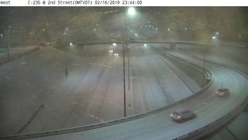
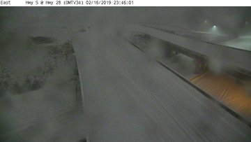
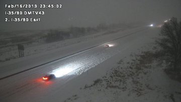
A widespread 3-6 inches of snow piled up in portions of eastern Nebraska and much of Iowa late Saturday and Saturday night, leading to treacherous conditions on Interstate 80.
During Sunday, snow and flurries will extend eastward through the Great Lakes and into Pennsylvania. An icy or wintry mix is likely to be focused from near the Ohio River to I-70.
Rain can also start as a period of freezing rain along Virginia's I-81 corridor on Sunday.
A wintry mix may extend across portions of West Virginia, Maryland, southern Pennsylvania, New Jersey and around New York City from Sunday afternoon into Sunday night.

Through Sunday night, some snow is forecast to push across more of northern Pennsylvania and into southern and central New England. The snow can leave 1-3 inches and cause slippery travel before winding down on Monday.
"There can be locally higher snow totals of 3-6 inches from near the I-90 corridor of New York State to the mountains of central New England," according to AccuWeather Senior Meteorologist Kristina Pydynowski.
Second storm to bring areas of heavy snow, ice and rain
The big storm of the bunch will roll northeastward from the Gulf coast on Tuesday, and it will track along or just west of the Appalachians on Wednesday and then exit the Northeast states on Thursday.
Since this storm will have a great deal of moisture available to it from the Gulf of Mexico and the Atlantic Ocean, a substantial amount of precipitation is likely.

Heavy rain is likely to fall on parts of the lower Mississippi, Tennessee and Ohio valleys, southern Appalachians and the lower part of the mid-Atlantic. Enough rain may fall to cause flooding problems.
However, as the storm encounters progressively colder air to the north, areas of ice, wintry mix and snow are in store.
The storm and its moisture, similar to the storm from early this past week, will run into a dome of Arctic air over New England. High pressure associated with that Arctic air will put up some resistance and keep some areas below freezing until the very last gasp of the storm.
At this time, one of the areas that may have to deal with a heavy buildup of ice may extend from far northwestern North Carolina and eastern West Virginia to western Virginia, western and central Maryland to parts of central and southern Pennsylvania.
Critical to the potential for widespread power outages and downed trees will be the form the ice takes. Sleet would tend to bounce off these elevated surfaces while freezing rain would adhere to them.
RELATED:
The Great American Race: What weather to expect for Daytona 500 this Sunday
Mudslide ransacks homes in Sausalito as an atmospheric river fuels flooding across California
Flood, severe weather dangers to ramp up in southeastern US around midweek
AccuWeather 2019 US spring forecast
The Great American Race: What weather to expect for Daytona 500 this Sunday
Mudslide ransacks homes in Sausalito as an atmospheric river fuels flooding across California
Flood, severe weather dangers to ramp up in southeastern US around midweek
AccuWeather 2019 US spring forecast
A swath of snow is likely to extend from parts of northwestern Texas to northern Illinois, Wisconsin, Michigan, Minnesota northern New York state and northern New England.
The wintry mix zone with snow, rain and some ice may encompass a broad area from north-central Texas to central Illinois, northern Pennsylvania, southern New York state, northern New Jersey and southern New England.
There can also be enough of a wintry mix to cause slippery travel and disruptions along the I-95 corridor from Washington, D.C., to New York City, Boston and Portland, Maine, for a time during the storm.
Download the free AccuWeather app to stay alert to the forecast for your area.


No comments:
Post a Comment