Friday, January 31, 2020

Flooding fears renewed as persistent rainfall targets Paraguay, southern Brazil

SEVERE WEATHER Updated Jan. 31, 2020 6:08 AM


Although flooding rain has already hit parts of Brazil so far in 2020, more rain and flooding could strike the southern part of the country in the coming week.
In addition to southern Brazil, other parts of South America may also be threatened.
"A stalling front will lead to daily rounds of showers and drenching thunderstorms into early next week," said Accuweather Senior Meteorologist Jason Nicholls.
The rounds of showers and thunderstorms are expected across southern Brazil and into Paraguay, Bolivia and extreme northern Argentina.
Even amid normally wet stretch of the year in January and February, when some cities see over 200 mm of rain (about 8 inches) in a month's time, some communities could total this much rain in just a single week.
"The heaviest rain, and the greatest risk for flooding, is anticipated from Parana into Sao Paulo and Mato Grosso do Sul in southern Brazil," added Nicholls.
This will also be the area where locally strong thunderstorms are anticipated. These storms are likely to produce heavier downpours, damaging winds and even some hail.
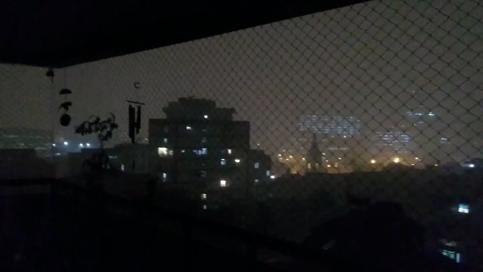
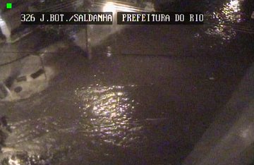
Strong thunderstorms pushed through Rio de Janeiro on Thursday night, causing street flooding and downed trees.
Power outages were also reported throughout the city on Thursday night.
RELATED:
In southern Brazil and into southern and central Paraguay, widespread rainfall amounts of 50-100 mm (2-4 inches) are expected through Monday, with pockets of rain that could surpass 150 mm (6 inches) of rain. The cities of Asuncion in Paraguay and Porto Alegre in Rio Grande average only about 100 mm (4 inches) of rain in a month this time of year.
Much of the heaviest rain through the middle of next week is expected to stay south and east of some of the areas hardest hit in January, including the city of Belo Horizonte.
Firefighters search for victims near houses destroyed by a landslide after heavy rains in Barreiro, Minas Gerias state, Brazil, Saturday, Jan.25, 2020. The death toll caused by record rainfall in southeastern Brazil jumped on Sunday and officials expressed alarm about continuing storms. (Flavio Tavares/Futura Press via AP)
More than 50 deaths were attributed to flooding and landslides from heavy rainfall that hit the city on Jan. 24.
While the heaviest rain is not anticipated to reach the Belo Horizonte region, some steadier rain may return late next week. Even a small amount of rain, given how wet it has been since the start of the year, could lead to the return of flooding issues.
Keep checking back on AccuWeather.com for more updates.

10 cities poised for upcoming heating cost savings

WINTER WEATHER Updated Jan. 30, 2020 3:24 PM


To borrow from Game of Thrones, “Winter is coming.” 
But is it, really? 
Americans might be wondering about that considering it’s almost February and, as AccuWeather senior meteorologist Dave Samuel pointed out, "For most of the country, there really has not been much of a winter. In fact, we had one of the warmest Januarys in history across the country.”
The tepid winter so far along with AccuWeather’s forecast for what’s ahead mean people throughout the U.S. can expect to see substantial savings in home heating costs – those for natural gas, heating oil and electricity – compared to the 2018-19 season and also compared to the long-term normal. That’s based on the exclusive AccuWeather 90-day forecast, which is available at AccuWeather.com (search your city to view the monthly outlook); you can also keep apprised of your forecast on the free AccuWeather app.
AccuWeather predicts residents in the following cities particularly will benefit based on the percentage change in savings from Sept. 1, 2018 to April 27, 2019 compared to Sept. 1, 2019 to April 27, 2020, based on AccuWeather’s forecast. There are also cost savings when comparing 2019-20 to each city’s long-term normal. (See highlights here and farther below, as well as the 12-city breakdown in the slideshow.
Estimated home heating costs on the ⬇️ for the following cities in 2019-20 compared to 2018-19 from 9/1-4/27, based on AccuWeather’s 90-day forecast.
Cincinnati: ⬇️ 6.9 percent
Dallas: ⬇️ 13.2 percent
Kansas City: ⬇️ 9.1 percent
Minneapolis: ⬇️ 7.1 percent
AccuWeather meteorologists predict seasonable winter weather will occur across most of the U.S. beginning in February. “There have been some changes over the past week which could be a sign that the pattern will be changing after Groundhog Day, meaning February and early March can still deliver plenty of cold and snow across the U.S.,” Samuhel said. 
The exception would be in the West, where it will be warmer over the next six weeks, so an early spring seems likely, noted Samuhel. 
The heating season runs from Sept. 1 through the following April or May. The actual costs of electricity and fuel vary from year to year and from place to place, so the percentage change in consumers’ bills may vary from these percentages, which assume other heating-related costs are largely unchanged year-over-year.  
A number of steps can be taken to keep heating costs under control in times of high demand. Some tips to follow this winter include, most simply, monitoring thermostat settings. In addition, homeowners can replace worn weather strips and ensure that heating equipment is well maintained to curb costs. Also, upgrading a home's insulation can lead to significant savings on energy costs.
Estimated home heating costs on the ⬇️ for the following cities in 2019-20 compared to the long-term normal from 9/1-4/27, based on AccuWeather’s 90-day forecast.
Boston: ⬇️ 10.1 percent
Cincinnati: ⬇️ 9.3 percent
Dallas: ⬇️ 9.2 percent
Los Angeles: ⬇️ 19.6 percent
San Francisco: ⬇️ 12.0 percent
Washington, D.C.: ⬇️ 9.5 percent
AccuWeather.com’s full U.S. spring forecast will be released Feb. 5, 2020.

Keep checking back on AccuWeather.com and stay tuned to the AccuWeather Network on DirecTV, Frontier and Verizon Fios.

Newfoundland could be blasted by 2nd bomb cyclone in 2 weeks

Snow covers cars in Paradise, Newfoundland, Canada, Jan. 18, 2020, in this image obtained from social media. (Kim Porter/via REUTERS)
A storm system that is expected to barely brush the East Coast of the United States late in the week will end up bringing the brunt of the impactful weather to Atlantic Canada over the weekend.
The upcoming system is set to track over the same region that experienced record-breaking snowfall and storm-force wind gusts less than two weeks ago.
The atmospheric disturbance that will eventually bring unsettled weather to Atlantic Canada is currently taking shape over the northern Gulf of Mexico.
AccuWeather meteorologists will continue to monitor the storm as it first takes aim across the Southeast on Friday. With a lack of an atmospheric blocking pattern, the storm system is expected to maintain a quick pace as it is forecast to brush by the East Coast Friday night into Saturday.
As warm Atlantic air clashes with a cooler continental air mass in place over the Northeast, rapid strengthening is expected to take place over the ocean through the day on Saturday. As a result, increasingly gusty winds are expected to develop across much of Nova Scotia by Saturday evening.
Depending on the magnitude of strengthening, it is possible that bombogenesis may take place this weekend, which would make it the second bomb cyclone to strike part of the region in a space of two weeks. Bombogenesis is generally defined as when the central pressure of a storm system drops at a rate of at least 0.71 of an inch of mercury in 24 hours.
Static Bombogenesis version 2 (inches)
As the storm system tracks closer to Atlantic Canada during the day Saturday, the location of the center of the storm system will play a major role in determining the expected impacts across the region. A shift of only 50 miles (80 kilometers) in the expected track can essentially make or break a forecast in a storm situation like this.
Current forecasts bring the center of the storm system very close to the coast of Nova Scotia. Moderate to heavy snow is likely to develop Saturday night into Sunday morning across much of the province, as well as Prince Edward Island. However, a change to rain will take place in the southeast part of Nova Scotia and then in southeastern Newfoundland.
Depending on the magnitude of the wind, blizzard conditions may be possible for a time where rain does not mix in over the northwestern parts of Nova Scotia and Newfoundland.
The transition between rain and snow will likely hang very close to the coast as the storm tracks northeastward this weekend. For places like Halifax, this will make all the difference in the forecast.
If the center of circulation can remain far enough offshore, that will result in the warmer air staying out to sea, yielding nearly all snow across the province. This scenario would bring heavy snow to the Halifax area with limited or no changeover to rain during the storm. In this scenario, snowfall totals of 20-30 centimeters (8-12 inches), with locally higher amounts could be realized.
RELATED:
A track closer to the coast will yield more mixed precipitation and much lower snowfall totals for coastal Nova Scotia. If the storm system trends toward this solution, much of coastal Nova Scotia could expect 10 centimeters (4 inches) or less.
Currently, a changeover to an icy mix or plain rain is in the forecast for the Halifax area sometime late Saturday night into Sunday morning before switching back to snow briefly on the back end of the storm. Again, the duration of this changeover will make major differences in the total snowfall accumulation.
Part of northern Nova Scotia and western Newfoundland are forecast to receive 30-45 centimeters of snow with an AccuWeather Local StormMax™ of 50 centimeters.
Newfoundland will experience the brunt of the storm on Sunday. Recall that less than two weeks ago, a storm system caused the city of St. John's to undergo a state of emergency for days following the storm as over 60 centimeters (2 feet) of snow fell, creating snowdrifts over 5 meters (16 feet) in spots.
A resident makes their way through the snow in St. John's, Newfoundland on Saturday, Jan. 18, 2020. The state of emergency ordered by the city of St. John's is still in place, leaving businesses closed and vehicles off the roads in the aftermath of the major winter storm that hit the Newfoundland and Labrador capital. (Andrew Vaughan/The Canadian Press via AP)
If the storm system continues along its expected track, a changeover to rain would likely occur around St. John's sometime on Sunday as warm air surges northward into Newfoundland.
Regardless of precipitation type, additional unsettled weather will not fare well for the recovery efforts across Newfoundland this weekend. If rain comes down for a time, it will act to compact the snowdrifts in place, but it will also raise the risk for flooding across the region. Where most of the precipitation falls as snow, new snowdrifts will just pile up on the existing snowpack in place, hindering cleanup efforts.
Currently, a "mainly snow" scenario looks unlikely across southeastern Newfoundland.
"While not enough rain is likely to fall to wash away all the snow and lead to disastrous flooding, street flooding can occur where massive piles of snow are blocking storm drains," according to AccuWeather Senior Meteorologist Alex Sosnowski.
"The deep snowpack is likely to absorb much of the rain, but that added water content in the snow may have to be dealt with as potential major flooding later in the season during a rapid thaw and/or rainstorm," Sosnowski said.
One bit of good news is that this storm system will likely move in and out of the region rather quickly, limiting the potential for major snowfall accumulations. In general, most locales will receive around 12-18 hours of wintry weather before the storm moves out.
"Although the storm this weekend is likely to be significant, it's not the same caliber of storm that hit on Jan. 19," Sosnowski said.
The storm is expected to lift off into the north Atlantic during the day Monday, bringing an end to the winter weather and gusty winds. Aside from a few hit-or-miss snow showers early week, generally quiet conditions are expected into midweek in the wake of the storm.
Keep checking back on AccuWeather.com and stay tuned to the AccuWeather Network on DirecTV, Frontier and Verizon Fios.

Scary body cam footage shows deputy saving woman after she fell into icy water

WINTER WEATHER Updated Jan. 30, 2020 12:40 PM


Two fishermen and a Macomb County deputy pulled Korisa Miller out of the icy water after she slipped and fell in while fishing in Harrison Township, Michigan, on Monday.
The fall occurred after Miller tried to stand up and lost her footing, and she plunged into the icy waters of Lake St. Clair around 3:20 p.m EST.
According to a Facebook post from Macomb County Sheriff’s Office, one of Miller's friends, Melissa Kovlowski, was only one dock away and looked over to see her struggling after hearing the fall. She tried to pull Miller up but was unable to, as her body had gone numb.
"I just kept screaming at her," Kovlowski told WXYZ-TV Detroit. "I said you gotta stay up, you gotta stay up, you gotta keep your head up."
Korisa Miller was in the water for about 15 minutes before being rescued. (Facebook / Macomb County Sheriff's Office)
Two other fishermen in the area came to help after hearing her cries, but they were also unable to pull her back onto the pier. The fishermen instead held her arms up to prevent her from drowning until the deputy arrived.
By the time the deputy made it to the scene along with the Harrison Fire Department, Miller had already been in the icy water for 15 minutes.
Miller was wearing a hoodie at the time she fell in, which had ended up floating around her neck, and the officers had to remove it so it would not choke her as she was pulled out of the lake.
Miller's body had gone numb, making it impossible for her friend to pull her up. (Facebook / Macomb County Sheriff's Office)
Body camera footage from the deputy shows him rushing to the pier where Miller had fallen. After he arrives, they were able to quickly pull her out of the icy water.
According to AccuWeather Senior Meteorologist Paul Walker, the temperature in the area the day and time of the fall was around 35 degrees Fahrenheit, but because of 17-mph winds coming from the southwest and slight snow and freezing drizzle in the area, the RealFeel® Temperature was most likely in the high teens. In Detroit, about 26 miles away, the RealFeel® was 19 F. 
The Facebook post said the water was 36 F that day; however, Walker said it may have actually been in the upper 20s, which he said was “something you don’t want to expose your body to.”
“You wouldn’t want to be in the water with these temperatures,” Walker said. “You could suffer from hypothermia very quickly.”
RELATED:
Miller was “doing better” by the next day, according to the sheriff’s office.
"Thank you everyone who had been praying for me and asking if I am okay," Miller posted on Facebook on Tuesday. "I am just bruised and sore but I am okay."
She went on in the Facebook post to respond to people who had body-shamed her after the video was released, and explained that "the reason why I gave permission to show the video is to show awareness on how dangerous fishing can be. I am glad I am alive and share my story. This isn’t going to stop me from doing what I love. I am now keeping rope and life vests near me. So the Haters are going to hate and it isn’t going to get me because of my story someone will not make that mistake."
Miller's fall took place while she was fishing in Lake St. Clair. (Youtube / WXYZ-TV Detroit)
The sheriff’s office advised people who may end up in a similar situation not to panic and to get as much of your body out of the water as possible, stay close to the area rather than swim away, search for a personal floatation device in nearby water to put on if not already wearing one, leave clothing on and form a fetal position to reserve as much body heat as possible.
If you fall into water in a group of people, huddling together will help retain body heat and make the group more visible to rescuers, the sheriff's office said in a Facebook post. 
They also recommend making very minimal movements if swimming is necessary so as to conserve energy and be prepared to flag down any potential rescuers passing by. After, they advise seeking immediate medical help.
Keep checking back on AccuWeather.com and stay tuned to the AccuWeather Network on DirecTV, Frontier and Verizon Fios.

Man missing at sea for nearly 2 weeks found alive in life raft off Washington coast

  One of two men missing at sea for nearly two weeks was found alive on Thursday by a Canadian fishing boat in a life raft in Canadian water...