Thursday, August 1, 2019

These 4 US cities will feel summer warmth linger into autumn

By Chaffin Mitchell, AccuWeather staff writer


It may feel like an endless summer for parts of the United States this year, as fall, well, falls back and higher-than-normal temperatures linger longer.
Much of the Northeast and the mid-Atlantic I-95 corridor can expect to have temperatures 3 to 3.5 degrees above normal this September. Also, for much of the Northwest above-normal warmth will continue deeper into fall, according to AccuWeather meteorologists.
Spokane, Washington, (3.5 degrees above normal), Portland, Oregon, (2.5), Baltimore, (1.5-2), and Washington, D.C., (1.5-2) are four U.S. cities expected to feel the extended summer warmth. Baltimore and Washington, D.C., averaged temperatures 1.5 to 2 degrees above normal last fall also, while Portland was 1 degree above normal and Spokane was around its average temperature. 
Volume 0%
 

“Like the past few seasons, the East will enjoy late-summer weather and vacations at the beaches," said AccuWeather Lead Long-Range Meteorologist Paul Pastelok. "And the Pacific Northwest to east of the Cascades will get the worst of the heat and dryness, particularly in the beginning of the season."
It is worth noting that the averages and stats above are from meteorological fall (Sept. 1 - Nov. 30) as opposed to Sept. 23 - Dec 21.
Impacts of lingering heat into fall
This will continue the heat and humidity the Northeast has already experienced for much of the summer. Estimated costs for cooling from May 1 through July 30 compared to normal cooling costs are higher in a number of cities in the Northeast, according to an AccuWeather analysis.
Boston (31.6% higher), Washington, D.C., (23.9%) and Philadelphia (19.9%) have seen significantly higher estimated cooling costs compared to normal.
Unfortunately, "The [higher] temperatures will add to the wildfire risk for areas of the Northwest," Pastelok cautioned.
Much of Washington and parts of Oregon are already at severe or moderate drought levels, according to data from the United States Drought Monitor.
The higher temperatures could also delay the peak fall foliage for parts of the U.S., as well as mean a possible late start to ski season for many, Pastelok added. 
high temps four 4 us cities

Download the free AccuWeather app to see the forecast for your location. Keep checking back for updates on AccuWeather.com and stay tuned to the AccuWeather Network on DirecTV, Frontier and Verizon Fios.
Podcast banner for news stories

Erick, Flossie to team up and spread wet weather, rough surf across Hawaii

By Alex Sosnowski, AccuWeather senior meteorologist


While Erick and Flossie are past their peak and are forecast to avoid a direct hit on Hawaii, expect both tropical features to cause more widespread showers and building seas around the islands in the coming days.
While a major disaster is not anticipated, enough rain is likely to fall to interrupt outdoor plans and bring less-than-ideal weather conditions for vacationers over a several-day period. Incidents of flash flooding are likely, especially on the Big Island.
Satellite Erick 10 am
This image shows Erick to the southeast of the Big Island of Hawaii on Thursday, August 1, 2019. (NOAA / Satellite)

Surf may get too rough for beachgoers and inexperienced boarders. All swimmers and boarders should heed local restrictions. Rip currents will increase in strength and number over the next several days.
Erick is weakening but still brings some risk to Hawaii
Into this weekend, the first system to deliver a glancing blow will be Erick.
Erick Track 10 am

Erick is forecast by AccuWeather meteorologists to pass well south of the islands and continue to weaken. Its closest approach to Hawaii will be to the Big Island during Friday morning local time.
"The heaviest rain from Erick will impact the east-facing higher terrain of the Big Island into Friday," according to AccuWeather Hurricane Expert Dan Kottlowski.
Erick Impacts

Enough rain can fall on the east-facing slopes to cause flash flooding and mudslides on the Big Island.
Heavier-than-usual showers are expected to spread westward over the islands of Maui, Moloka'i and O'ahu with perhaps a few incidents of urban and small stream flooding into the weekend.
As Erick passes by as a tropical storm, it will cause an initial increase in the trade wind breezes over much of the island chain before breezes diminish or change direction later this weekend.
"Erick has already generated a large swell that will bring rough surf to mostly east- and south-facing coastal areas of the islands," according to AccuWeather Hurricane Expert Dan Kottlowski.
Late this weekend, there is a chance that Erick turns a bit more to the north and reduces its forward speed after it passes the westernmost islands.
This slowdown and northward drift could generate a light but prolonged southerly breeze of tropical moisture over the islands, especially from Ni'ihau and Kauai to O'ahu.
In this scenario, there is the potential for persistent unsettled conditions and shower activity. This could occur in areas that are typically sheltered from rainfall during the trade winds such as Honolulu and Kekaha.
If Erick maintains forward speed and continues moving more to the west early next week, then conditions are likely to improve over the islands, especially on O'ahu, Kauai, Moloka'i and Maui.
How might Flossie impact the islands?
Meanwhile, Flossie is a few days behind and to the east of Erick over the Pacific Ocean.
AccuWeather meteorologists expect Flossie to take a west to northwest track toward Hawaii into this weekend with an eventual turn more to the north.
Flossie Track

How soon that more northward jog occurs may determine the amount of showers from the second wave of moisture and rough surf to affect the islands.
While there is a considerable amount of dry air in between both Erick and Flossie at present, that may change this weekend. Hence, the concern for ongoing wet conditions.
Erick and Flossie wide view
This image shows Erick just southeast of Hawaii and Flossie well to the right on Thursday, August 1, 2019. (NOAA / Satellite)

While continuous rain is not expected, there is the potential for a extended period of unsettled weather over much of the island chain as a result of the two tropical systems.
Erick and Flossie won't be the last tropical systems to affect Hawaii this year.
“The island chain will likely be subject to even more tropical threats in the coming months as AccuWeather meteorologists expect an above-normal hurricane season in the Eastern and Central Pacific,” according to AccuWeather Meteorologist Reneé Duff.
Download the free AccuWeather app to keep track of the latest tropical activity. Keep checking back for updates on AccuWeather.com and stay tuned to the AccuWeather Network on DirecTV, Frontier and Verizon Fios.
Podcast banner for news stories

Microburst confirmed in Boston as severe storms trigger flash flooding in Northeast

By Mark Puleo, AccuWeather staff writer


Major cities from Philadelphia to New York City to Boston found themselves flooded on Wednesday evening thanks to a series of thunderstorms that rolled through the Northeast.
In Natick, Massachusetts, a pregnant mother and her 3-year-old son were trapped in their car when the vehicle stalled.
"I saw a few other cars going, so I just thought 'I'm next,' but then it almost felt like a boat as I was floating," the mother, identified as Michelle Lopes said. "I'm eight months pregnant, so I just thought I would sit and wait."
Elsewhere in Natick, trains were halted by flooding on tracks.
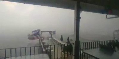
The strongest winds were reported at Boston Logan International Airport, where a mircroburst with 74-mph gusts wrecked travel plans, and in Winthrop, Massachusetts, where a South Boston yacht club was rocked.
winds

The drenching downpours caused transportation issues throughout the region. Over 300 flights were delayed in Boston.
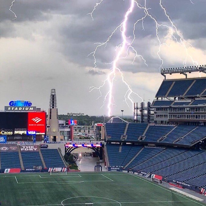
One weather enthusiast captured a remarkable glimpse of a lightning strike over the skyline in downtown Boston. A similarly stunning shot was captured over Gillette Stadium.
In New Jersey, over 34,000 homes and businesses were left without power, according to nj.com.
Newark Liberty International Airport reported departure delays of at least 45 minutes, according to FlightAware, while inbound flights were delayed up to four hours.
In eastern Pennsylvania, downed trees and power lines caused damage in Philadelphia. Some reports of hail were reported in the suburbs of Philadelphia, such as in Langhorne.
Golf ball-sized hail was reported in parts of New Hampshire. 
hail

New York City was also dealt difficult conditions on Wednesday evening, especially for those looking to use public transportation.
Passengers on the S-40 bus found themselves sitting in a puddled bus in a section of Richmond Terrace as the bus drove through Staten Island. A source told The Post that the driver did report the flooding, but the bus was able to continue its route without problem.
Download the free AccuWeather app to know how high temperatures will soar in your community. Keep checking back for updates on AccuWeather.com and stay tuned to the AccuWeather Network on DirecTV, Frontier and Verizon Fios.
Podcast banner for news stories

August to kick off on dry, pleasant note in northeastern US

By Kyle Elliott, AccuWeather meteorologist


Although rounds of drenching, gusty storms were the norm across the Northeast during the last few days of July, a change in the weather pattern will allow the first few days of August to be dry in New England.
The slow-moving cold front that was responsible for days of scattered showers and storms was forced southward as an area of high pressure expanded eastward from the Great Lakes into New England.
Residents will be treated to nearly perfect weather conditions for outdoor activities for the bulk of the first week of August across the northern tier with low humidity and mainly rain free conditions.
NE Friday

High temperatures through Saturday will range from the 70s Fahrenheit across the higher terrain of the central Appalachians to the Green and White mountains and the 80s in the lower elevations and major cities of the I-95 corridor.
Comfortable humidity levels and plenty of sunshine will provide an ideal setting for those flocking to New England and New York beaches or engaging in outdoor activities such as hiking, biking, fishing and golfing.
The lower temperatures and humidity will reduce the risk of heat-related illnesses for anybody engaging in strenuous or prolonged outdoor activities and also allow most people to turn off the air conditioning unit for a while.
Cooling demand will be lower than it has been in weeks, which is good news for residents hoping to save on their electric bills.
People planning on spending time outdoors through this weekend should keep in mind that the sun angle is still very high this time of year and apply sunscreen frequently to avoid receiving a bad sunburn.
Unfortunately, the drier air will not be able to push southward into the southern mid-Atlantic as the frontal boundary stalls across the region and combines with tropical moisture streaming northward from the Atlantic.
Residents near and south of the Mason-Dixon Line will face daily rounds of scattered showers and storms through at least the first half of the weekend, and some of these storms are forecast to creep back northward into Pennsylvania and New Jersey on Friday and Saturday following the mainly dry weather from Thursday.
Sat Downpours Static

While severe weather is not anticipated, any storms that do develop could be slow-moving and produce locally heavy rainfall that could trigger incidents of flash flooding in cities such as Baltimore, Richmond and Washington, D.C.
With the clouds and moisture sticking around in the southern half of the mid-Atlantic, it may still feel oppressive to those that are sensitive to higher humidity and may not allow residents in these areas to turn off the AC.
How far north the threat for showers and thunderstorms gets on Friday and Saturday will depend on the strength of the high pressure and any subtle shifts of the nearly stationary frontal boundary.
AccuWeather meteorologists foresee little change in this weather pattern into at least the first half of next week, with any cold fronts failing to make headway into the southern mid-Atlantic.
Download the free AccuWeather app to keep track of the latest temperature trends in your community. Keep checking back for updates on AccuWeather.com and stay tuned to the AccuWeather Network on DirecTV, Frontier and Verizon Fios.

This Date in Weather History for August 1,2019

Weather History
For Thursday,August 1,2019


1954 - Mount Rainier in Washington State was still covered with sixteen inches of snow at the 5500 foot level following a big snow season. (David Ludlum)
1985 - A nearly stationary thunderstorm deluged Cheyenne, WY, with rain and hail. Six inches of rain fell in six hours producing the most damaging flash flood of record for the state. Two to five feet of hail covered the ground following the storm, which claimed twelve lives, and caused 65 million dollars property damage. (Storm Data)
1986 - A powerful thunderstorm produced 100 mph winds and large hail in eastern Kansas and southwestern Missouri causing 71 million dollars damage, and injuring nineteen persons. It was one of the worst thunderstorms of record for Kansas. Crops were mowed to the ground in places and roofs blown off buildings along its path, 150 miles long and 30 miles wide, from near Abilene to southeast of Pittsburg. (The Weather Channel)
1987 - Record heat gripped parts of the Midwest. A dozen cities reported record high temperatures for the date, including Lincoln, NE, with a reading of 105 degrees, Moline, IL, with an afternoon high of 103 degrees, and Burlington, IA, with a reading of 102 degrees. (The National Weather Summary)
1988 - Two dozen cities in the Upper Midwest reported record high temperatures for the date, including La Crosse WI with a reading of 105 degrees. Highs of 103 degrees at Milwaukee, WI, and South Bend, IN, were records for the month of August. (The National Weather Summary)
1989 - Hurricane Chantal made landfall along the Upper Texas coast about sunrise. Chantal deluged parts of Galveston Island and southeastern Texas with 8 to 12 inches of rain. Unofficial totals ranged up to twenty inches. Winds gusted to 82 mph at Galveston, and reached 76 mph in the Houston area. Tides were 5 to 7 feet high. The hurricane claimed two lives, and caused 100 million dollars damage. (The National Weather Summary) (Storm Data)

Man missing at sea for nearly 2 weeks found alive in life raft off Washington coast

  One of two men missing at sea for nearly two weeks was found alive on Thursday by a Canadian fishing boat in a life raft in Canadian water...