Linda Lam
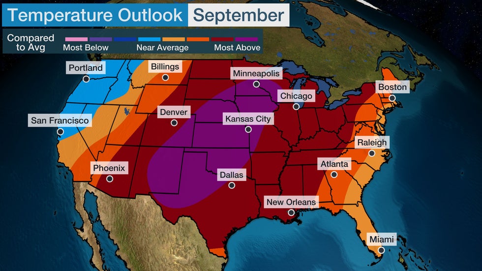
Hotter than average temperatures are expected to be widespread across the Lower 48 in September, meaning that the first month of fall might not bring much relief from summer heat, according to the updated outlook from The Weather Company, an IBM Business, and Atmospheric G2.
What changes are in the latest September outlook? The updated temperature forecast has trended notably warmer given recent trends in the computer model guidance.
Temperatures will overall be the farthest above average throughout most of the Plains and into the upper Midwest. Warmer than average conditions will extend into most of the East, as well as into the Rockies and Southwest. Areas right along the East Coast and in Florida may be near average or slightly warmer.
The only area that could be near to slightly cooler than average is the Northwest into Northern California.
 September Temperature Outlook
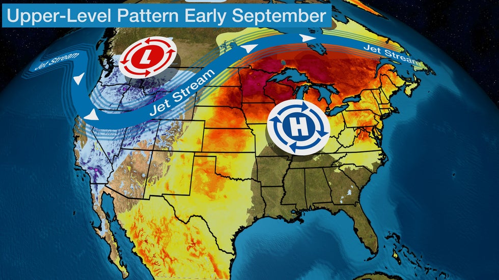
What's driving the September outlook? The dominant upper-level pattern the models are expecting to be in place features an upper-level ridge of high pressure over parts of the Midwest, with a southward dip in the jet stream near the Northwest.
This pattern will influence temperatures across the Lower 48 for the first week of September. Highs and lows will be warmer than average, especially in the Midwest and Northeast beginning over Labor Day weekend. Record highs are possible for portions of the Plains, Midwest and Northeast over the first few days of the month.
"Given the latest guidance and the resemblance of the expected pattern to the top-5 aggregate September pattern, we've made sharp increases in forecast temperatures across the central and eastern U.S., with some cooler changes across parts of the West. The new forecast represents the third-warmest September on record and we may still be too cool," said Todd Crawford, Director of Meteorology at Atmospheric G2.
 Early September Pattern
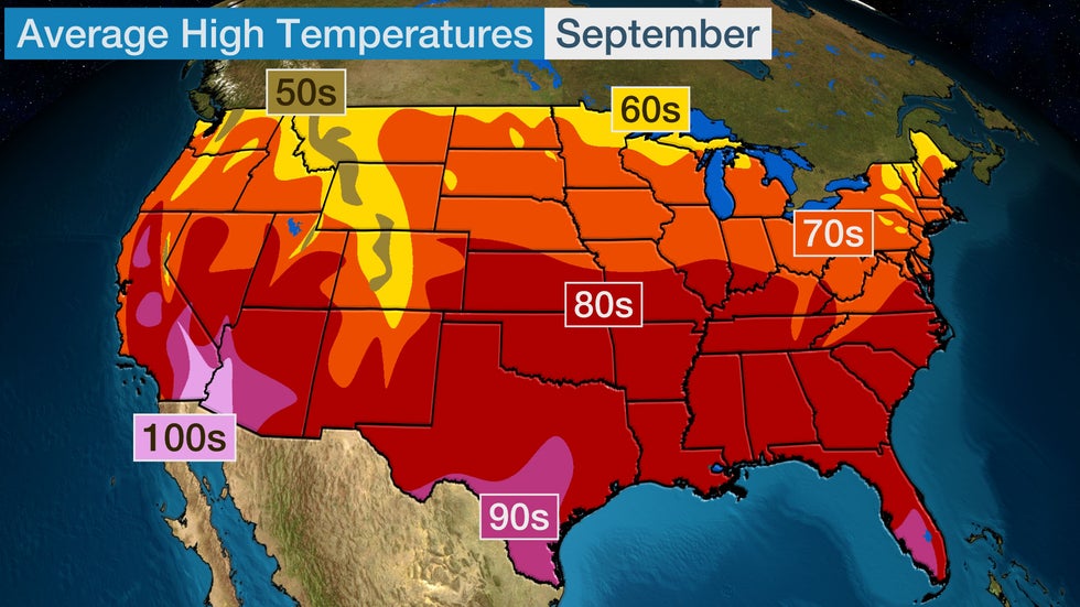
What does this mean compared to average? High temperatures trend a bit cooler from the beginning of September to the end of the month. Highs averaged over the whole month show a mild feel across the northern tier with 60s and 70s and even some 50s in the higher elevations of the West.
Farther south, highs remain toasty with temperatures rising into the 80s. Highs in the 90s are typical in parts of southern Florida, southern Texas, and in the Southwest, average highs in the 100s persist.
This suggests that for much of the central and eastern U.S. where a hotter than average month is expected, it will feel more like summer with highs in the 80s and 90s more likely.
 Average September Highs
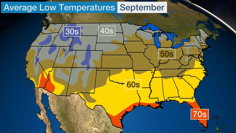
Mornings also trend cooler through the first month of fall. Lows drop into the 30s and 40s for much of the West, as well as across the northern tier and into portions of the interior Northeast.
Lows in the 50s and 60s are common for most of the East, Midwest and Plains. Mild mornings continue in Florida and along the Gulf Coast, as well as parts of the Southwest.
Given the current outlook, mornings may remain very mild with widespread lows in the 60s and 70s from the Plains to the East. Cooler conditions in the Northwest suggest mornings could feel a bit chilly.
 Average September Lows
Linda Lam is a senior meteorologist at weather.com. Growing up in Massachusetts she developed a fascination for winter storms and hurricanes that led her to pursue a career in meteorology.
The Weather Company’s primary journalistic mission is to report on breaking weather news, the environment and the importance of science to our lives. This story does not necessarily represent the position of our parent company, IBM.
The Weather Company’s primary journalistic mission is to report on breaking weather news, the environment and the importance of science to our lives. This story does not necessarily represent the position of our parent company, IBM.

No comments:
Post a Comment