Jonathan Erdman
A tropical depression or storm is likely to form in the next few days between Africa and the Caribbean Islands as we near the peak of the 2023 Atlantic hurricane season.
Where is this system: Right now, it's over the far eastern Atlantic as marked by the "X" below. It's a disturbance known as a tropical wave, or African easterly wave. These disturbances in the atmosphere move from east to west off Africa into the Atlantic Ocean and are often the seeds of tropical storms and hurricanes.
The disturbance has been tagged as Invest 95L by the National Hurricane Center (NHC). This is a naming convention used by the NHC to track disturbances in the Atlantic that have some chance to form into a tropical depression or storm.
(MORE: What is an invest?)
Where and when it could develop: Most computer forecast models suggest it will likely develop into a tropical depression or storm around mid-week when it's between Africa and the Caribbean.
That area of likely development is highlighted in red on the map below. "Lee" will be the name given to the next Atlantic tropical storm.
A separate area closer to Africa is also being watched for development, but this potential system is most likely to curve out into the open Atlantic.
 Possible NHC Development
Could Invest 95L become a threat to land? The short answer is that it's too soon to tell.
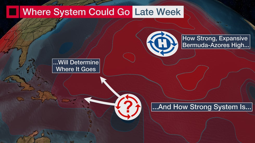
Assuming a tropical depression or storm does form, a combination of factors will determine where it goes.
That includes how strong and expansive the Bermuda-Azores high is at the time. This acts as a steering wheel for tropical waves, storms and hurricanes in the tropics.
If this Bermuda-Azores high is weaker and less expansive, that means this system could recurve into the central Atlantic without threatening land. If the high is stronger, more expansive and builds westward, that could steer this system farther west and potentially become a threat to at least parts of the Caribbean.
The timing for any threat to the Caribbean would be around the weekend of September 9-10, but it's too early to determine what impacts there might be.

Check back with us at weather.com for the latest on this, and the 2023 hurricane season.
Jonathan Erdman is a senior meteorologist at weather.com and has been covering national and international weather since 1996. His lifelong love of meteorology began with a close encounter with a tornado as a child in Wisconsin. He studied physics at the University of Wisconsin-Madison, then completed his Master's degree working with dual-polarization radar and lightning data at Colorado State University. Extreme and bizarre weather are his favorite topics. Reach out to him on X (formerly Twitter), Threads and Facebook.
The Weather Company’s primary journalistic mission is to report on breaking weather news, the environment and the importance of science to our lives. This story does not necessarily represent the position of our parent company, IBM.
The Weather Company’s primary journalistic mission is to report on breaking weather news, the environment and the importance of science to our lives. This story does not necessarily represent the position of our parent company, IBM.

No comments:
Post a Comment