Chris Dolce
An atmospheric river is pummeling California with drenching rains that could trigger debris flows and flooding while feet of snow pile up in the Sierra Nevada.
SPONSORED: Epic winter clearance sale at Sierra Trading Post
Here's the latest status on the storm followed by the forecast.
Happening Now
A low-pressure system near the West Coast has guided a long plume of Pacific moisture called an atmospheric river into the coast of California. You can see the ribbon of moisture in the dark green and yellow shadings in the map below.

The heaviest band of rainfall from this storm system has spread into west-central California, and it's now stalled until Thursday morning, after which it will slowly progress southward toward Southern California into Friday.
Meanwhile, this storm's wintry side, named Winter Storm Orlena by The Weather Channel, is bringing heavy snowfall and blizzard conditions to the Sierra Nevada.
(MORE: Orlena to Spread Toward Midwest, Northeast Into Next Week)
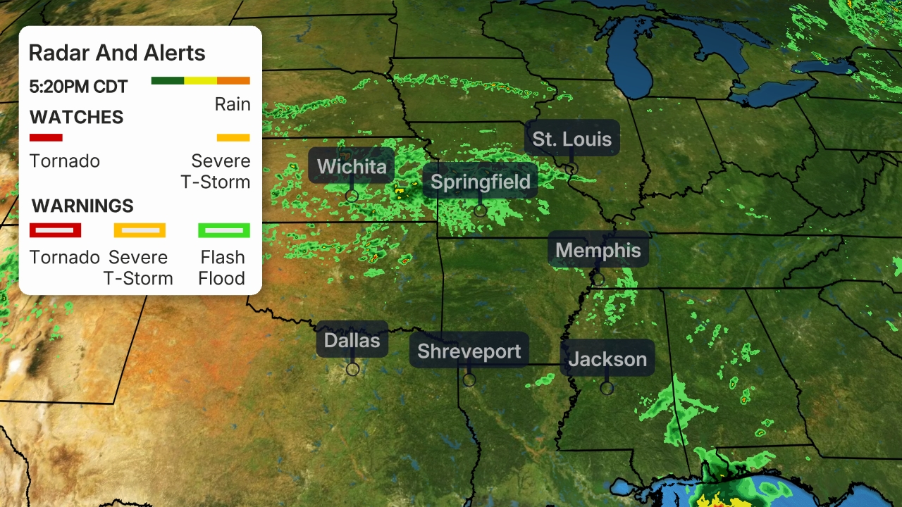 Current Radar
The storm system has prompted flash flood warnings to be issued on Wednesday morning for several burn areas to the south of the Bay Area.
Rainfall totals have topped 5 inches in higher elevation locations between Monterey Bay and San Luis Obispo.
A mudslide was reported Wednesday on the Pacific Coast Highway along the Big Sur coast south of Monterey at mile marker 27. A debris flow off the River Fire burn scar was reported south-southeast of Salinas.
(MORE: Homes Damaged By California Mud Flows)
High winds knocked out power to more than 400,000 homes and businesses in Northern California at one point early Wednesday, according to poweroutage.us. Wind gusts over 60 mph were clocked in the Sacramento metro area.
Blizzard conditions were reported late Tuesday on Interstate 5 in far Northern California near the town of Weed, where at least 20 inches of snow had fallen.
Parts of the Sierra and Siskiyous have already picked up 2 feet or more of snow as of Wednesday afternoon.
Flood, Debris Flow Forecast
Flash flood watches have been issued by the National Weather Service (NWS) from the Sacramento Valley and San Francisco Bay area down the Big Sur Coast as well as in parts of the L.A. Basin and San Diego metro area.
In Northern California, greatest concern was debris flows off land recently charred by wildfires, including the Dolan and River Fire scars near Big Sur, the CZU burn scar in the Santa Cruz Mountains, the SCU scar east of San Jose and various burn scars in Napa and Sonoma Counties.
In Southern California, the Bobcat, Lake, Ranch2, El Dorado, Apple and Bond Fire burn scars are of most concern for debris flows later Thursday into Friday.
 Flood Alerts
The greatest rainfall totals from this event will be in coastal parts of west-central California, as well as the foothills of the Sierra below snow level, which is where the atmospheric river moisture plume is expected to be most persistent through Thursday. This includes locations south of the Bay Area to Big Sur and parts of San Luis Obispo and Santa Barbara counties.
Rainfall totals in elevated locations along the coast from north of Los Angeles northward to areas south of San Francisco could be up to an additional 5 to 8 inches. Lower elevations may pick up 3 or more inches of rain.
Soaking rain from this system will eventually pivot southward toward the L.A. Basin and San Diego metro areas Thursday into Friday.
 Rain and Snow Forecast
Snowfall Forecast
The highest elevations in the Sierra could pick up 8 feet of snow through Friday.
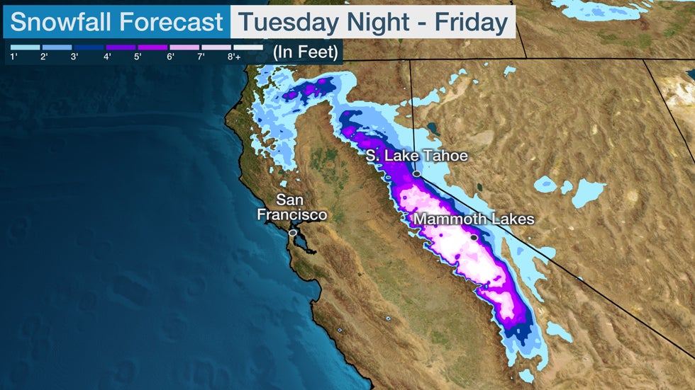 Storm total snowfall late Jan. 26-Jan. 29.
Although this snowpack is beneficial for California's water supply and ski areas, it will also be hazardous to travel.
Travel will be difficult or impossible in the Sierra at times through late week, including Interstate 80 through Donner Pass. The heavy, wet snow might also contribute to some tree damage and power outages, and whiteout conditions are possible, at times.
A blizzard warning has been posted by the National Weather Service for the highest elevations of Sierra near the border between California and Nevada, where whiteout conditions with wind gusts over 50 mph were expected. Caltrans urged travelers to finish travel to or through the Sierra by sunset Tuesday night.
 Winter Weather Alerts
The Weather Company’s primary journalistic mission is to report on breaking weather news, the environment and the importance of science to our lives. This story does not necessarily represent the position of our parent company, IBM.
The Weather Company’s primary journalistic mission is to report on breaking weather news, the environment and the importance of science to our lives. This story does not necessarily represent the position of our parent company, IBM.


No comments:
Post a Comment