| |
| Above: A historic blizzard pummels Nederland, Colorado, on March 13, 2019. The storm dumped up to 52” of snow in the Colorado Rockies, winds gusted to 97 mph in Colorado Springs, and the storm (whose barometric pressure bottomed out at 968 mb or 28.60”) broke all-time low pressure records in several cities and unofficially in the state of Colorado. Image credit: Helen H. Richardson/Media News/The Denver Post via Getty Images. |
March has historically been the most extreme month of the year weatherwise, and 2019 has been no exception. Among other impressive weather events, March 2019 has produced:
- record cold (–46°F in Montana early in the month, a preliminary state monthly record)
- record warmth (79°F in Seattle, Washington, on March 19, an all-time March record, and 81°F in coastal Quillayute, which smashed its previous March record by 8°F!)
- one of the most powerful storms on record in the Southern Plains
- historic flooding along portions of the Missouri River
Why does March have such extreme U.S. weather?
Simply put, March is the transition month from winter to spring, when northern snowpacks are often peaking while sunlight is increasingly strong. The battle between winter’s Arctic air and spring’s subtropical air plays out across the eastern two-thirds of the country, resulting in all manner of extreme weather. Temperatures during the month have ranged from –50°F (Snake River, Wyoming, in 1906) all the way to 108°F (Rio Grande City, Texas, in 1954).
On March 27, 1984, Brownsville, Texas, recorded its hottest temperature on record (for any month) with 106°F. This is the only major site in the U.S. to have measured their hottest temperature on record during the month of March. As for cold, the only significant site I’m aware of that has broken its all-time coldest temperature during March is Waterloo, Iowa, with a –34°F reading on March 1, 1962 (later tied on January 16, 2009). There is no other month of the year in the contiguous U.S. that has seen at least one all-time record high and all-time record low temperatures broken.
March has hosted some of the most calamitous weather events in U.S. history. Below is a look at some of the most extreme of these.
March 1888: Deadliest Blizzard in U.S. History
No blizzard in American folklore rivals the fame of the Blizzard of ’88, which struck New York and southern New England on March 11-13, 1888. Snowfall totals of up to 58” buried the region, winds gusted to hurricane force, and temperatures plunged into the single digits. Some 400 people perished, including 200 in New York City alone. A detailed account of the blizzard
can be found here.
 |
| Figure 1. The blizzard of March 11-13, 1888, was the deadliest snowstorm in American history, with the loss of at least 400 lives. Some 200 of these were in New York City, where people literally froze to death or were buried under huge drifts in the streets of Manhattan. Above is a rare image of the storm in progress on Wall Street. Trinity Church can be seen in the background. Image credit: The New-York Historical Society, whose name is hyphenated for historical reasons. |
Many other superlative snowstorms have, of course, occurred in March, with the most notable being the so-called Storm of the Century of March 12-15, 1993. No other single storm has covered such a vast swath of territory, broken such a variety of records, or disrupted the lives of so many Americans as this storm did. The National Weather Service posted
an excellent summary of the storm. Also see the NCDC (now NCEI)
Technical Report with additional record-breaking statistics.
 |
| Figure 2. The Storm of the Century, also known as the Superstorm of March 12-15, 1993, was the most massive nor’easter to ever affect the Eastern Seaboard. A total of 274 people perished, including 48 at sea. The storm broke numerous snowfall, barometric pressure, and cold records during its lifespan. Above is an enhanced infrared satellite image of the storm when it was at its strongest on March 13, while centered over coastal Virginia. Image credit: NOAA. |
March 1913: Deadliest Regional Flood in U.S. History
The deadliest regional flood event in U.S. history, and the second deadliest U.S. flood of any kind barring those associated with tropical cyclones, took place in Ohio the last week of March 1913. Four days of heavy rain soaked the entire state, with 11.16” falling in Bellefontaine. Extreme flooding began along all of the state’s rivers, with record flood stages along the Miami River in Dayton where it crested some 34 feet above flood stage. The flooding took 467 lives, including 123 in Dayton alone. The water reached a depth of 18 feet in Dayton’s Railway Station, and 600 people were trapped there for three days before the water receded.
 |
| Figure 3. Dayton, Ohio’s Fifth Street submerged under 10 feet of water during the city’s most catastrophic flood on record in March 1913. Some 123 people perished in the city alone with another 300 fatalities elsewhere in the state. Image credit: Montgomery County Historical Society. |
March 1925: Deadliest Tornado Outbreak in U.S. History
On March 18, 1925, a swarm of tornadoes, of which nine reached F2 or stronger intensity, scoured the landscape across Missouri, Illinois, Indiana, Alabama, Tennessee, and Kentucky. One tornado (although this may have been a series) of F5 intensity leveled towns along a 219-mile path from eastern Missouri through Illinois and into Indiana, killing 695. All in all, at least 747 lost their lives during the event, which makes this the deadliest tornado outbreak and single deadliest tornado event in U.S. history.
 |
| Figure 4. Griffin, Indiana, was completely wiped out by the deadly Tri-State Tornado on March 18, 1925. The tornado killed 695, including 71 in and around Griffin. Image credit: U.S. National Archives. |
Other notable March tornado events include the tornado swarm in the Southeast on March 21-22, 1932, when 36 twisters rated F2 or stronger killed 330 from Kentucky to South Carolina, making it the fourth deadliest tornado outbreak on record. On March 23, 1913, Omaha, Nebraska, was devastated by a tornado that killed 103 in and around the city.
March 1962: The Great Atlantic Storm
Until Hurricane Sandy in October 2012, the extratropical (non-tropical) storm of March 5-8, 1962 was the most devastating weather event in New Jersey history. A persistent and powerful low-pressure system off the mid-Atlantic Coast coincided with abnormally high tides, resulting in the destruction of almost every pier in coastal New Jersey along with some 5,000 structures. At least 40 residents perished, and the damage was over $1 billion in today’s valuation.
 |
| Figure 5. The USS Monsen was beached near Holgate, New Jersey by winds of 70 mph and waves 40-feet high during the Great Atlantic Storm of March 5-8, 1962. At the time it was one of the costliest extratropical storms on record for anywhere in the U.S., with over $1 billion (inflation adjusted) in damage to homes and infrastructure along the coasts of New Jersey and Delaware. Image credit: Karl Von Schuler. |
March 1914 and 1932: Lowest Barometric Pressure for a Non-Tropical Cyclone
March is famous for hosting some of the most intense nor’easters to affect the East Coast (as noted above in the snowstorm section). It was during two of these cyclones that the lowest barometric pressure measurements ever observed in the U.S. (for a non-tropical storm) occurred.
On March 2, 1914, a powerful nor’easter came ashore on Long Island, New York, with a central pressure of 952 mb (28.10”) as measured at Bridgehampton. (New York City set its record for lowest pressure ever measured with a 28.38” reading.) The 952-mb reading at Bridgehampton, however, is not accepted as official by NCEI. It is another March storm that holds the official record: the storm of March 7, 1932, when the barometer fell to 955 mb (28.20”) at Nantucket, Massachusetts (a similar reading was also observed in Canton, New York on January 13, 1913).
These pressure readings are equivalent to the central pressure of a major Category 3 hurricane. Note that Hurricane/Superstorm Sandy of October 2012 did not transition to an extratropical storm until just before it made landfall in New Jersey, with a pressure reading of 949 mb (28.01”) measured in Atlantic City.
 |
| Figure 6. What remains as probably the most intense extratropical storm to come ashore in the contiguous U.S. was the nor’easter of March 1-3, 1914. New York City observed its lowest barometric pressure on record with a 28.38” reading, as noted in the column of the Weather Bureau map for March 2 above. Further east on Long Island, a pressure of 28.10” (952 mb) was measured in Bridgehampton. This would be the lowest pressure ever measured anywhere in the contiguous U.S. (official or not) during an extratropical storm, if we exclude Sandy. Image credit: Daily Weather Maps, NOAA Central Library. |
March 2012: The Most Anomalous “Heat Wave” in U.S. History
What is probably the most anomalous heat wave in U.S. history, so far as the persistence of record daily maximum temperatures and their departures from normal, occurred March 13-22, 2012, in the Upper Midwest, Great Lakes, Northeast, and southeastern Canada. Temperatures averaged more than 40°F above normal in many of the areas affected for days on end. For a detailed analysis of this event see
my blog on the subject posted in March 2012.
In conclusion, it is likely safe to say that no other month of the year produces such an array of record-breaking extreme U.S. weather as the month of March. The month may sometimes go out like a lamb, as the saying goes, but it can roar like a lion at any point from the 1st to the 31st!
Christopher C. Burt
Weather Historian


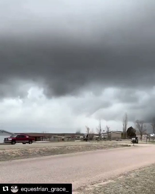
 credit: @equestrian_grace


